_250x250_cropped.JPG)
January 07, 2018
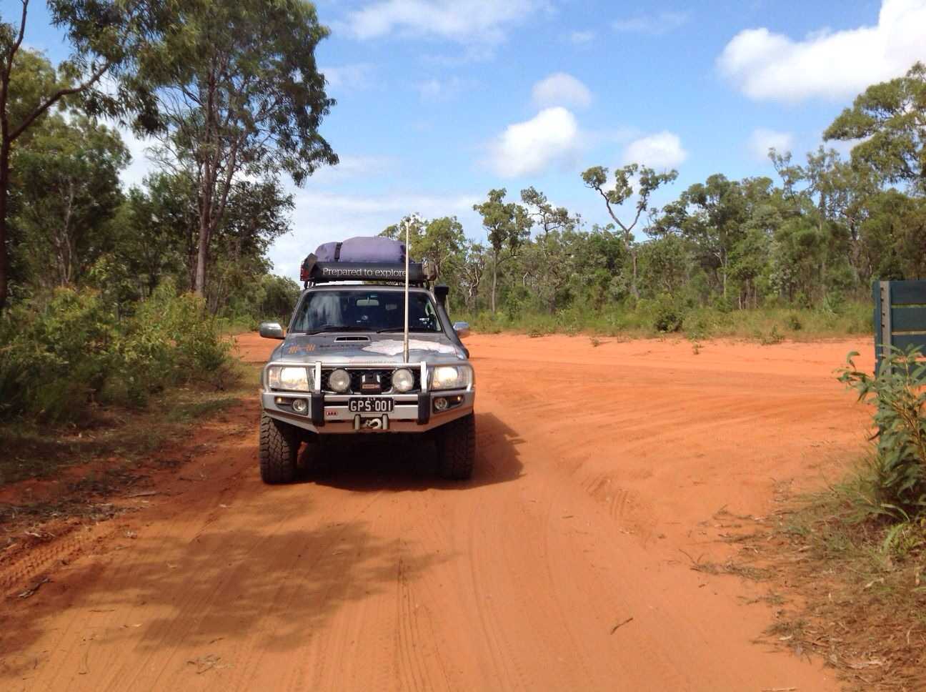
2017 The Gorge and Old Grafton Rd Trip
1492 km
Day-1: Left Home at 8:30am and met up with the other family that we were travelling with at the BP Servo and then headed off towards Stanthorpe where we refuelled; had a quick bite to eat, bought some stuff that we
had forgotten and then pushed onto hopefully our 1st casmpsite for the Trip - at teh Boonoo Boonoo River Crossing.
Reached the Boonoo Boonoo River early in the Arvo only to find the the spot we wanted already taken.
After looking around a bit, we decided just to set up camp on the opposite side of the road as there was a bit of a flat area that would do for one night. Kids jumped out went straight for the water to explore and go
swimming while we setup camp for the night. Once setup we headed off down the river to check things out and found some nice spots to cool off and relax. Managed to find some wood and got a fire started to cook on and
then spent some time around the campfire before heading off to bed.
Day-2: Early rise and pack up and headed off around 9am making our way south to the Hwy then turning east to Tabulum where we turned south onto Clarence Way. Came to our 1st Clarence River Crossing which would
be another
great Free spot for Camping. We pushed on then turned on Canham Rd and then stopped for lunch on Canham Bridge on the Clarence River - another beautiful spot to relax at. After lunch we pushed on to reach
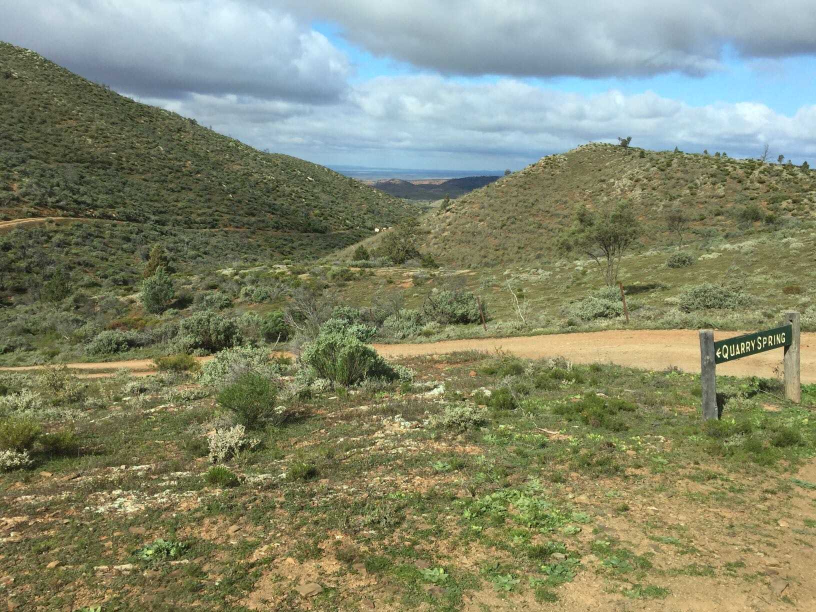
the Mann River following this southwards. Along this stretch there was again some fantastic free camping along the Mann River. We reached the turnoff where we could the normal way into The Gorge or come in from the
back way through the Forestry - We chose the back way :). This turned out a little more difficult that we had expected, having to make a few backtracking but it turned out to be a "long" but fun way to get into the Park and
required some 4wdriving as well with some very steep inclines and declines so we found out. After what seemed hours we eventually reached the Park late in the arvo to setup camp along the banks of the Clarence River
where we were to stay for the next 4 nights.
Day-3: A Hot Day spent lazing around camp, swimming and fishing, etc. The clouds started to move in giving a little relief from the heat We realized we made a mistake but not putting out the solar panels to charge the
batteries as we realized that the batteries took a big hit from the hot day - this was to be a problem in the following days
Day-4: Woke up to another hot but cloudy day with the low batteries which was a bit of a concern this early into our stay. We re-positioned one of the cars in a way that we could use the car to transport us to the
homestead and the small Creek gorge for a swim and to get out of the heat. Went for a bit of a drive also to try and put some charge back into the batteries and also try and get a signal to find out the weather forecast.
Had a late dinner to the sounds of a
storm building in the distance. As night fell we cleaned up dinner and closed up tents in prep for the coming rain. Then, suddenly out of no where a cyclone intensity type of storm (winds
@ 100+ mph) hit us out of nowhere not giving us any time and we got slammed with all my awnings being damaged & us being pinned between the Landy & the collapsed awning, unable to really move due to the force of
the wind, being pelted from Hail and the whipped up sandy gravel from the ground. Once the Storm had past, we set about trying to find our missing Tents and other gear that had been blown up to 150mtrs down the river.
In regards to the awnings, we managed to salvage one and temporary fix another that we could continue to use for shade for the rest of our stay at the Gorge. We eventually got to bed around 3am in the morning.....
Day-5: Woke up to all our gear being wet but at least we had sunlight to help dry things out. We spent the rest of the morning surveying the surrounding damage from the night before storm, spending the time drying out
everything and looking for some of our gear that was blown away. A few things we couldn’t find but most we did, even though it was some considerable distance away. We heard a few reports of people being injured to the
point that they needed hospital attention... The rest of the day we spent recovering and getting things ready for the New Years celebration.
Day-6: New Years Day - woke up to the weather not looking that flash in regards to solar charging our batteries, so with our batteries at a very low level, the decision was made to pack up, go for a swim in the rock pool
and then head out to the Mann River Caravan Park. The day became hotter and more humid as we slowly packed up. We eventually finished packing up and headed to the rock pool for a swim & cool down before making
our way out of the Park and twds our next nights camp at the Mann River Caravan Park to recoup and chill out from what we had been through.
Day-7: Rose to an overcast morning as we started the pack up, r
November 14, 2017
2017 - DefenderSoloDaytrip(WEB)
272.6 kmA last-minute trip to find some lookout points up in the Bellthorpe SF and then explore some of the Kandanga Forest Reserve where I found another Fire Tower had been knocked down - damn shame, then return home via the West Branch Rd following the Brisbane River down to Moore.

2017DefenderSoloTrip (39).JPG
April 25, 2017
2017 - Brooyar, Wrattens & Amamoor State Forest Explore Trip
283.5 kmDistance Travelled: 531kms
Driving Time: 11hrs 23mins
Fuel Economy for Trip: 13.3ltrs/100kms (fully loaded)
Link to a hillclimb at Amamoor that we mucked around on. The video's a bit rough, but u get the idea: https://youtu.be/PYyo9uQ5Ao0]Amamoor SF Hillclimb - 2 LR's and a Dmax
Link to Photos here: http://s217.photobucket.com/user/macca67/library/LANDROVER%20related/LANDROVER%20TRIPS/2017AnzacAmamoorWeekend]Anzac Weekend Amamoor Trip Photos
Day.1
Well, with another long weekend (sort of) it was decided that we needed to make use of it, so 3 families got together and planned a short overnighter, exploring the areas that I had been to before, but always enjoy returning to. The Plan was to head north to Gympie, then turn left towards Kilkivan, but then turning off to visit and check out the Glastonbury Campgrounds (go for a bit of a explore around there) then head back out via Point Pure (great L/O & where they do Rock Climbing/Abseiling) and Eagles Nest. From there it would be back on the Hwy towards Kilkivan and then turning south to check out the Mount Clara Smelter Chimney and continue southwards to our planned camp at Cedar Grove at Amamoor SF.... That was the sort of plan anyway...
Due to kids weekend sporting commitments, we headed off early Monday morning and made good time to stop for a well deserving early morning coffee and a bite to eat before continuing onwards to get to our 1st destination - Glastonbury Campgrounds. This turned out to be a great to camp as they have appeared to improved it some what from the last time I was there - except for the Toilet block :( I was questioned as to where
the track continued through the park and I smilingly said to a possible mud hole..... Well, we had to go and check it out and yes, we found some mud :) As I was the tour guide, it was me who was to test out the mud hole and luckily, it had a firm base and we both got through without any issues. From there we followed the tracks that I had shown on my GPS and we just did a bit of a loop and then made our way back out via the main entrance of the campgrounds and onto our next stop - Point Pure Lookout. This is always a beautiful spot with a great lookout. This time we also got to watch some Rock Climbers climb up the vertical cliff - very impressive. Time was getting on and we pushed onwards, calling into see Eagles Nest Lookout and back onto the Widebay Hwy to our next stop - Mount Clara Smelter Chimney.
Reached the Chimney in good time and let the mob out for a bit of a run around and to check the area out and it's history. From this point it was all offroad as we pushed on to our lunchtime destination - Mt Mia. The Threlkeld track is a loose and rocky track in parts but is definitely the more interesting way to get to our destination. Reached Mt Mia for a much deserved rest stop where we all took in the views and had a fantastic meal for lunch and a cold drink and just took in the scenery and the usual photos.
As time was starting to get away from us, we had to make some adjustments to a planned route to our nights camp, so we took a more direct route to Cedar Grove Campgrounds via some more forestry tracks, eventually coming out onto Harts Rd and followed that in towards town before again turning off and cutting across to our campsite for the night, reaching there around 4pm which still gave us enough daylight to setup in the light and wait for our 3rd vehicle to join us. With one of the guys having his birthday that day, we ended up having a great night around the campfire relaxing & having a few drinks and chatting about the day's adventures. With firewood looking a bit short in supply, us blokes decided to head back down the road to buy some and also make good use of the time and do a bit of night driving to test out the mate's birthday present - Great White Light-bar and spotties. All I can say is AWESOME Lights :) - The lit up the surrounding bushland and made night into daylight. About a 1.5hrs later, us blokes eventually made it back to camp with most of the kids already a sleep. We continued of campfire chats for a little bit before all of us headed of to get some well deserved sleep.
Day.2
A lazily rise and breakfast for everyone and while the kids ran off playing and exploring the local area, the adults went about doing what they do - Packing up :( Once we were all packed, we headed off around 10am to start what would turn out to be a great day of 4wdriving. Not far from camp, we found a awesome steep track off and down to the left, so we walk a bit of it and decided to give it a go. All 3 cars headed down and we then suddenly came to a stop... We didn't quite walk far enough and we came across some serious washouts and what not. Upon not knowing if we continued down as to whether we could out the other side + the time used up to get ourselves back would seriously chew into our day so we decided to turn around and continue our exploring and leave that track for another time....
Not want
September 15, 2020
Created:
June 02, 2016
Karajarri Protected Area - Visitors Permit
87.4 kmThe Karajarri Protected Area Visitors Permit is for people wishing to visit and explore Mirntanymartaji and Purnturrpurnturr Country (the Port Smith and Gourdon Bay area). All visitors to these areas enter and travel at their own risk. You should ensure that you are adequately prepared.
A permit will only be issued once it has been paid for. It is valid for the vehicle, number of persons, destinations and time period indicated on the permit. The standard fees are:
$10.00 for a day permit
$15.00 for a weekend permit (includes long weekends)
$40.00 for a week permit (7 days)
$80.00 for an annual permit (starting from first date)
Please visit http://www.karajarriprotectedarea.com/Default.aspx to apply for a permit
March 16, 2018
Created:
October 29, 2014
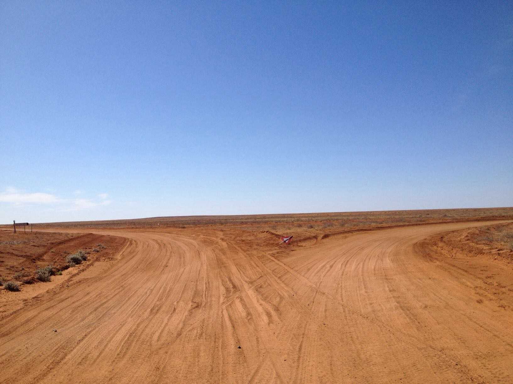
Lyndhurst to Cameron Corner 29/10/14
432.4 kmDay 16 Alice Springs Trip
Lyndhurst Hotel campground to Cameron Corner Store. Strzelecki Track mostly fast dirt with small sections of bitumen at creek crossings etc
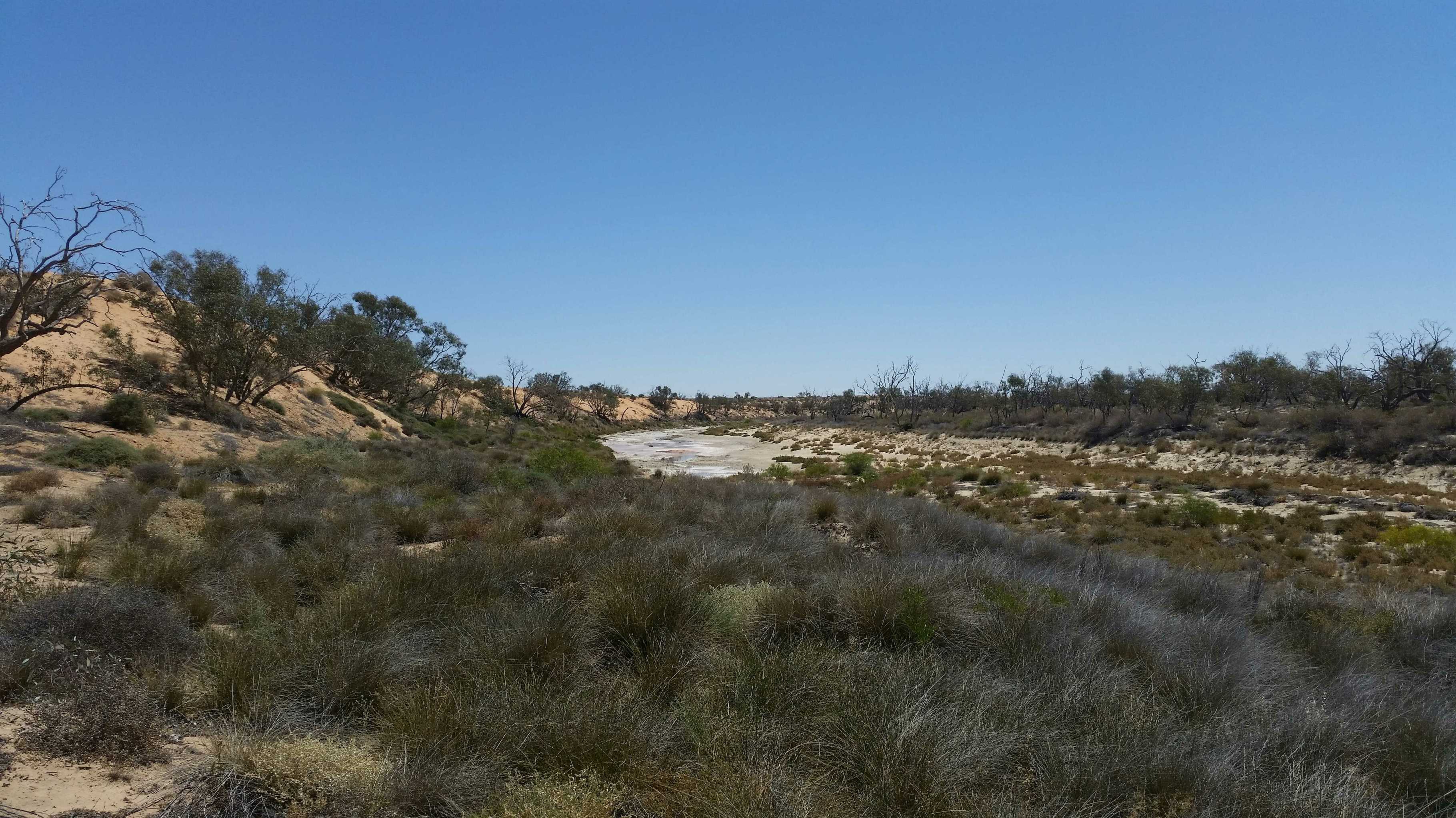
Yaninguri Waterhole
August 31, 2017
Created:
August 11, 2017
Geo Centre and Geosurveyors Hill 27/07/2017 12:18:51 PM
3357 kmWell..we did it too!
Vehicles:
Us: ’06 100 series TDA Toyota Landcruiser
Our follower was our 2012 Track Trailer Tvan
My brother: 2015 200 series TDA Landcruiser
Our route:
Coober Pedy..
Kulgera…
Old Andado Station…
Mac Clarke Reserve
Madigan Camps 1, 1a and 2
Colson Track
..cross country to:
Geosurveyor’s Hill
Cross country again to:
The Geographical Centre of the Simpson Desert
Then:
Cross country again (a defined track now!)
French Line
Knolls Track
Rig Road
Warburton Track
Birdsville Track
For all the detail geeks out there, I’ve put down some facts and figures for you.
Day 1
After John rested from a serious bout of “man flue”, we left Coober Pedy and headed to Kulgera
Distance: 410kms.. Fuel: 134 Litres… Price: $1.50/l 17 L/100
Tyres: F. 30lb B. 35 Tvan. 24
Our first camp was just out of Kulgera by a dry creek bed.
Bogan fleas (nasty prickles) everywhere, but good, plentiful wood.
Day 2
From Kulgera to west of Mac Clarke reserve, Via Old Andado Station.
Distance: 280km from Kulgera
Camped off the road between Old Andado and Mac Clarke Reserve
Day 3
To Mac Clarke Reserve, Madigan Camps 1, 1a &2, to The Colson Track.
40kms from the Madigan/ Colson track intersection, to our turn off to Geosurveyor’s Hill.
We photographed and passed all the obligatory abandoned fuel / oil drums shot line pegs and “points of interest”
Distance: 400km From Kulgera
There were some serious dunes which required a wide range of tyre pressures throughout the day.
We rocked, rolled, landscaped dunes, inflated and deflated our tyres all day
Tyre pressures were ranging from: F 25lb … B 32 lb …Tvan: 18
TO F 12 lb … B 17 lb … Tvan 12 lb
We only managed 60 kms that day…
Day 4 460 kms from Kulgera
We put 40 litres of fuel in the car..from our total of 60 l we were carrying in the Tvan. (keeping 20 portable litres as a reserve supply) We were following some very vague tyre impressions once we left the Colson, which disappeared on a few occasions. Overall, the 1 month old route we followed was visible enough.With some crazy dune approaches, sharp twists and turns of the faded track, we sometimes decided there was a better route up the dunes.There wasn’t any flat ground on this section of the track, so when we climbed a difficult dune, we decided it was the best spot to stay for the night!!!!We only did 32kms that day. Once again, looking at and photographing all the obligatory fuel dumps and drums…and the odd action shot of our “duning”
Not once did we get bogged, or lose traction. We picked up shovels..filled in some holes and tyre abuse on the track we were to climb, dropped our tyre pressures and got up without any trouble.
Day 5 492 kms from Kulgera
Started our tyre pressures that day at: F. 16 …B. 22…Tvan 12
Some really big dunes and a fair bit of landscaping today.We only managed 40kms that day, averaging 4km/hour.Some of the tracks we were following began to really wobble around and over the dunes, so a few better selections were taken that day again tooWe sighted the pimple in the distance from atop of a large dune and headed for the prize.Enjoying a beverage on top of Geosurveyor’s Hill and taking the obligatory photoshoot, we sighed and headed south!
Our camp was south of Geo SH
Day 6 531kms From Kulgera
Tyres: F 13 lb…R 19 lb…Tvan 12 lb
Heading south To the Geocentre today..lots of dune crossings , some W-E..a few switching back E-W. We only managed 68kms today.We thought it would be easier now that we were heading south..not really. The faint tracks were off in a different direction once we had left GSH, so we followed a bit more used track.Once again, a few routes previous travellers had taken, were a little “unusual” and not the easiest route they could have taken..so we made a couple of small side tracks. We reached the Geocentre, signed the book, looked at the tower and it’s ornaments and took the obligatory pictures……And sighed again!....We followed a now well-defined track, which ran along and top of the edge of the dunes. We made camp, where there was a flat spot AND some wood!
Day 7 599kms from Kulgera
We put in a big day today.One particularly obscure dune approach needed a serious reconsideration.With no room to position ourselves to cross this dune and no inclinations to re position the whole dune, we cleared and smoothed out another approach, which we climbed easily.This dune was more obnoxious though. It had yet another level to scale.So John did a loop on the lower level of the dune and once again, took a straighter route up the final distance.
Tyres down to: F 12…B 18…Tvan 12
Over this dune was a grove of gidgee trees, where John re- inflated the tyres a little.
By now, we were on the home run to the French Line.
My brother had headed south east (just left of the track we were following), to see if he could find a better way.At one point, we got a little “lost”, but discovered a fuel drum lying along a shot line on top of another dune. Of course..photographed it!
Eventually we both met up
20170803_105449.jpg
February 05, 2016
Created:
June 09, 2015
February 05, 2016
Created:
June 11, 2015
Geo Centre - Birdsville, June 2015
208.1 kmThe Geographical Centre of the Simpson Desert was officially marked by the CFA 4WD Club with David & Joan Owen and Rob & Dot Correa in 1993. In 1995 David & Joan Owen, Rob & Dot Correa and Geoffrey Owen erected the tower to identify the Geo Centre. It has 2 x VW hub caps on the top and can now be seen by planes flying over. This trip was to conducted by David & Joan Owen (Aussie Tracks) with Trevor & Stephanie Owen and David & Cheryl Sidebottom to celebrate the 20th anniversary of the erecting of the tower.

My Photo - 12/06/2015 8:25:03am
January 15, 2016
Created:
August 05, 2015
September 07, 2015
Created:
May 06, 2015
Offroad Adventure Show Episode 1 Coffs Harbour
92.2 kmFollow the team from the Offroad Adventure Show through Coffs Harbour. Including the Woopi Trail, Wahoo Trig Lookout, The Keyman and a great camp at Pebbley Beach.
My Photo - 8/05/2015 6:56:11am
May 18, 2015
Created:
June 01, 2014
Hema - Old Telegraph Track North
29.0 kmHEMA CAPE YORK ATLAS & GUIDE - TRACK #11
This track requires low range and high ground clearance in addition to appropriate traction aids. Driving from the turnoff to Fruit Bat Falls, we took the Mistake Creek turnoff to the Northern Bypass Road to avoid a swollen Nolan's Brook.
This is Track #11 from our Cape York Atlas & Guide, which you can purchase online here: http://bit.ly/capeguide