_250x250_cropped.jpg)
October 26, 2017
October 26, 2017
October 03, 2017
October 14, 2017
Created:
August 11, 2017
Geo Centre and Geosurveyors Hill 27/07/2017 12:18:51 PM
3357 kmWell..we did it too!
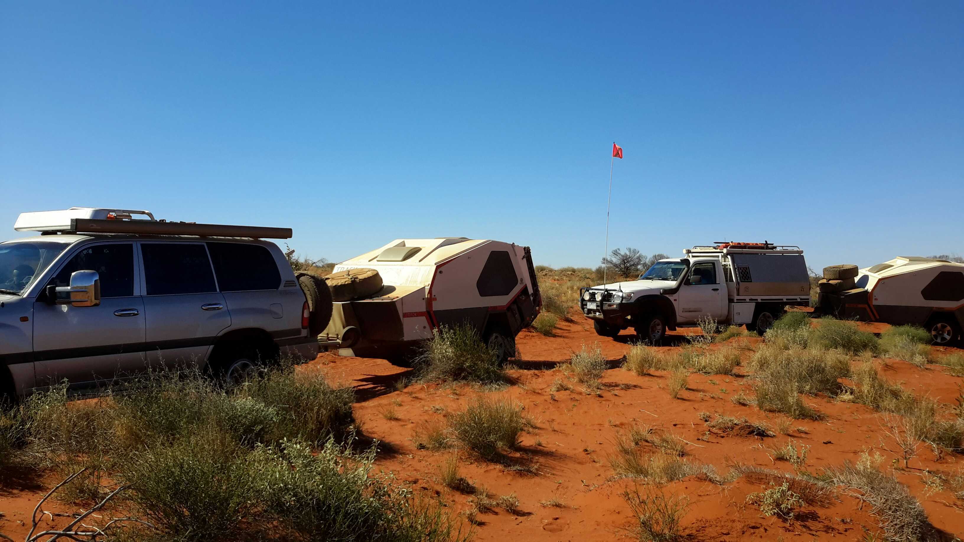
Vehicles:
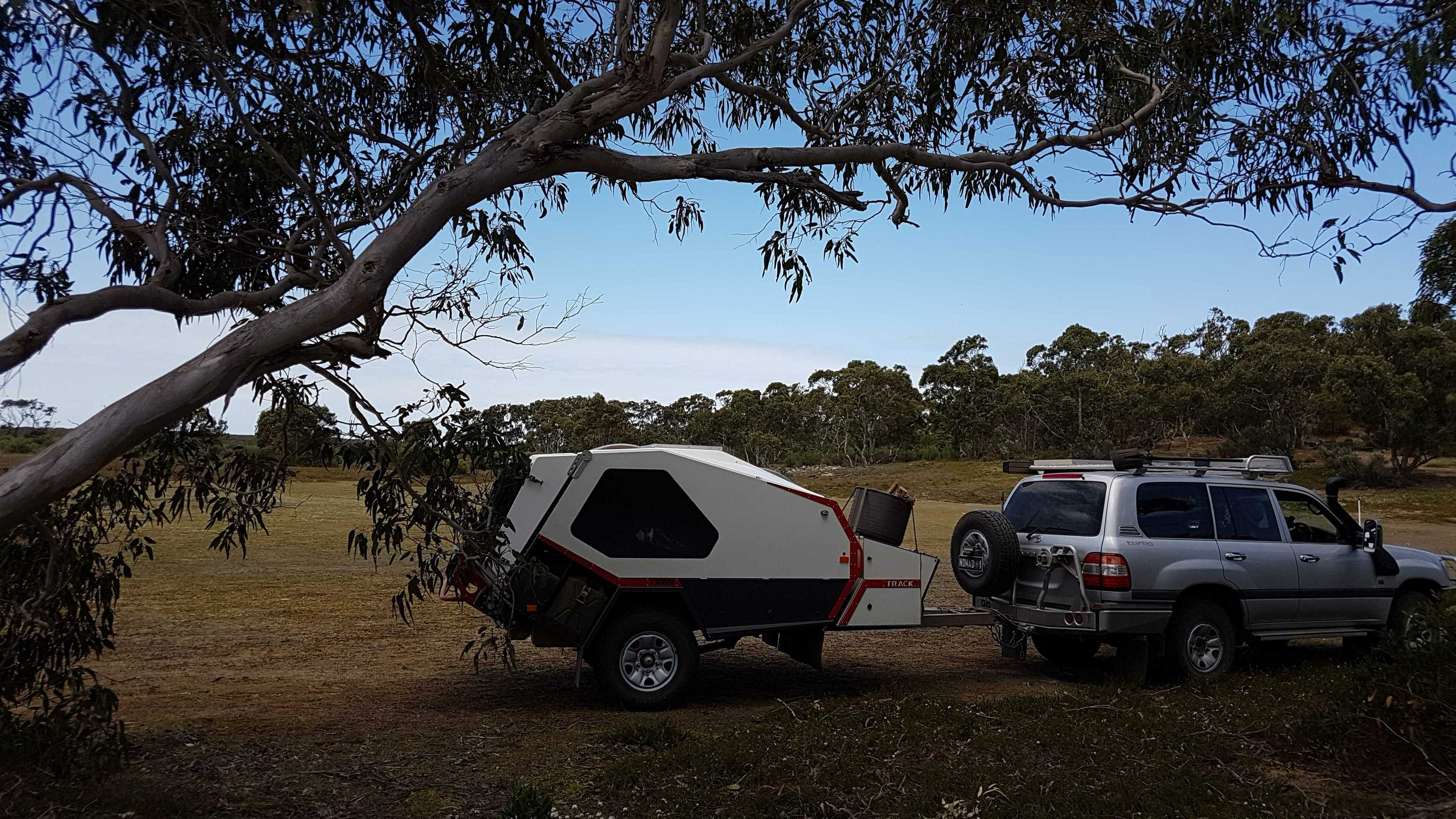
Us: ’06 100 series TDA Toyota Landcruiser
Our follower was our 2012 Track Trailer Tvan
My brother: 2015 200 series TDA Landcruiser
Our route:
Coober Pedy..
Kulgera…
Old Andado Station…
Mac Clarke Reserve
Madigan Camps 1, 1a and 2
Colson Track
..cross country to:
Geosurveyor’s Hill
Cross country again to:
The Geographical Centre of the Simpson Desert
Then:
Cross country again (a defined track now!)
French Line
Knolls Track
Rig Road
Warburton Track
Birdsville Track
For all the detail geeks out there, I’ve put down some facts and figures for you.
Day 1
After John rested from a serious bout of “man flue”, we left Coober Pedy and headed to Kulgera
Distance: 410kms.. Fuel: 134 Litres… Price: $1.50/l 17 L/100
Tyres: F. 30lb B. 35 Tvan. 24
Our first camp was just out of Kulgera by a dry creek bed.
Bogan fleas (nasty prickles) everywhere, but good, plentiful wood.
Day 2
From Kulgera to west of Mac Clarke reserve, Via Old Andado Station.
Distance: 280km from Kulgera
Camped off the road between Old Andado and Mac Clarke Reserve
Day 3
To Mac Clarke Reserve, Madigan Camps 1, 1a &2, to The Colson Track.
40kms from the Madigan/ Colson track intersection, to our turn off to Geosurveyor’s Hill.
We photographed and passed all the obligatory abandoned fuel / oil drums shot line pegs and “points of interest”
Distance: 400km From Kulgera
There were some serious dunes which required a wide range of tyre pressures throughout the day.
We rocked, rolled, landscaped dunes, inflated and deflated our tyres all day
Tyre pressures were ranging from: F 25lb … B 32 lb …Tvan: 18
TO F 12 lb … B 17 lb … Tvan 12 lb
We only managed 60 kms that day…
Day 4 460 kms from Kulgera
We put 40 litres of fuel in the car..from our total of 60 l we were carrying in the Tvan. (keeping 20 portable litres as a reserve supply) We were following some very vague tyre impressions once we left the Colson, which disappeared on a few occasions. Overall, the 1 month old route we followed was visible enough.With some crazy dune approaches, sharp twists and turns of the faded track, we sometimes decided there was a better route up the dunes.There wasn’t any flat ground on this section of the track, so when we climbed a difficult dune, we decided it was the best spot to stay for the night!!!!We only did 32kms that day. Once again, looking at and photographing all the obligatory fuel dumps and drums…and the odd action shot of our “duning”
Not once did we get bogged, or lose traction. We picked up shovels..filled in some holes and tyre abuse on the track we were to climb, dropped our tyre pressures and got up without any trouble.
Day 5 492 kms from Kulgera
Started our tyre pressures that day at: F. 16 …B. 22…Tvan 12
Some really big dunes and a fair bit of landscaping today.We only managed 40kms that day, averaging 4km/hour.Some of the tracks we were following began to really wobble around and over the dunes, so a few better selections were taken that day again tooWe sighted the pimple in the distance from atop of a large dune and headed for the prize.Enjoying a beverage on top of Geosurveyor’s Hill and taking the obligatory photoshoot, we sighed and headed south!
Our camp was south of Geo SH
Day 6 531kms From Kulgera
Tyres: F 13 lb…R 19 lb…Tvan 12 lb
Heading south To the Geocentre today..lots of dune crossings , some W-E..a few switching back E-W. We only managed 68kms today.We thought it would be easier now that we were heading south..not really. The faint tracks were off in a different direction once we had left GSH, so we followed a bit more used track.Once again, a few routes previous travellers had taken, were a little “unusual” and not the easiest route they could have taken..so we made a couple of small side tracks. We reached the Geocentre, signed the book, looked at the tower and it’s ornaments and took the obligatory pictures……And sighed again!....We followed a now well-defined track, which ran along and top of the edge of the dunes. We made camp, where there was a flat spot AND some wood!
Day 7 599kms from Kulgera
We put in a big day today.One particularly obscure dune approach needed a serious reconsideration.With no room to position ourselves to cross this dune and no inclinations to re position the whole dune, we cleared and smoothed out another approach, which we climbed easily.This dune was more obnoxious though. It had yet another level to scale.So John did a loop on the lower level of the dune and once again, took a straighter route up the final distance.
Tyres down to: F 12…B 18…Tvan 12
Over this dune was a grove of gidgee trees, where John re- inflated the tyres a little.
By now, we were on the home run to the French Line.
My brother had headed south east (just left of the track we were following), to see if he could find a better way.At one point, we got a little “lost”, but discovered a fuel drum lying along a shot line on top of another dune. Of course..photographed it!
Eventually we both met up
20170803_105449.jpg
July 18, 2017
Created:
June 30, 2017
March 21, 2016
Created:
July 12, 2015
Young Nomads ...Coober Pedy to Old Andado and Madigan Line Camps 1 to 25 and Birdsville to Isisford 12/7/2015 9:43:06 AVT
2649 kmThe Madigan Line:
From Mt Dare to Birdsville..758 kms
We used 174 litres of diesel in our 100 series turbo auto , towing our awesome TVan all the way....L/100 kms: 22L
We shared our Adventures with new found friends. Who were in a Nissan 4.2L Manual diesel ute with canopy and also were towing a TVan..They averaged 21L/100kms.
.The whole trip was spent in low range and we averaged 40ks a day.
We stopped at approx. 3-4o'clock in the arvo and often didn't leave to 9.30(on a good day), each day.
A very leisurely trip.
From Mt Dare, our last refuelling stop, we headed toward Old Andado Homestead. There was a large section of bulldust not far north of Mt Dare, which coated our car, drowned our Tvan and filled the car with lovelly fine dust..unfortunately our fan was on. We didn't expect such a large plume/ hole, so before we could close our vents, our car was powdered with superfine bulldust. mostly outside thank goodness.
The TVan was following us and remained dust free inside.
At old Andado, we enjoyed a bit of history and some fresh scones from the homestead caretakers.
Our first night out was not far out of Old Andado, still south of Mac Clarke Reserve.
Day 1 on the Madigan, as many have said, was interesting. The actual starting point to get to Camp 1 was on the western side of the fencline, which begins at the entrance gate to Mac Clarke reserve.
Following that fenceline, we reached the bore and had a look around...
There were lots of tracks going in all directions, but after eventually having to cross over a broken fence, we discovered the next way forward was actually north,now along the Eastern side of a fence...virtually doubling back on our track, but on the other side of another fence!
The scenery to camps 1 & 1A weren't that remarkable, until we got past camp 2
Camp 2 was near the old "fossil"..Case tractor which was very interesting. Why it was there at all is a mystery!
Camps 3&4 were not visited as they are on native title land, so we headed to the Colson, camp 5 and then camp 6. A bit longer day travelling
Camp 7 was really where the dunes started to get a little serious.. Deflated tyres even more, repair/ landscape a few dunes and move on peacefully..only one camp that day.
Camp 8-10 a continuation of the previous days terrain, with some beautiful colours of the sand changing throughout the day.
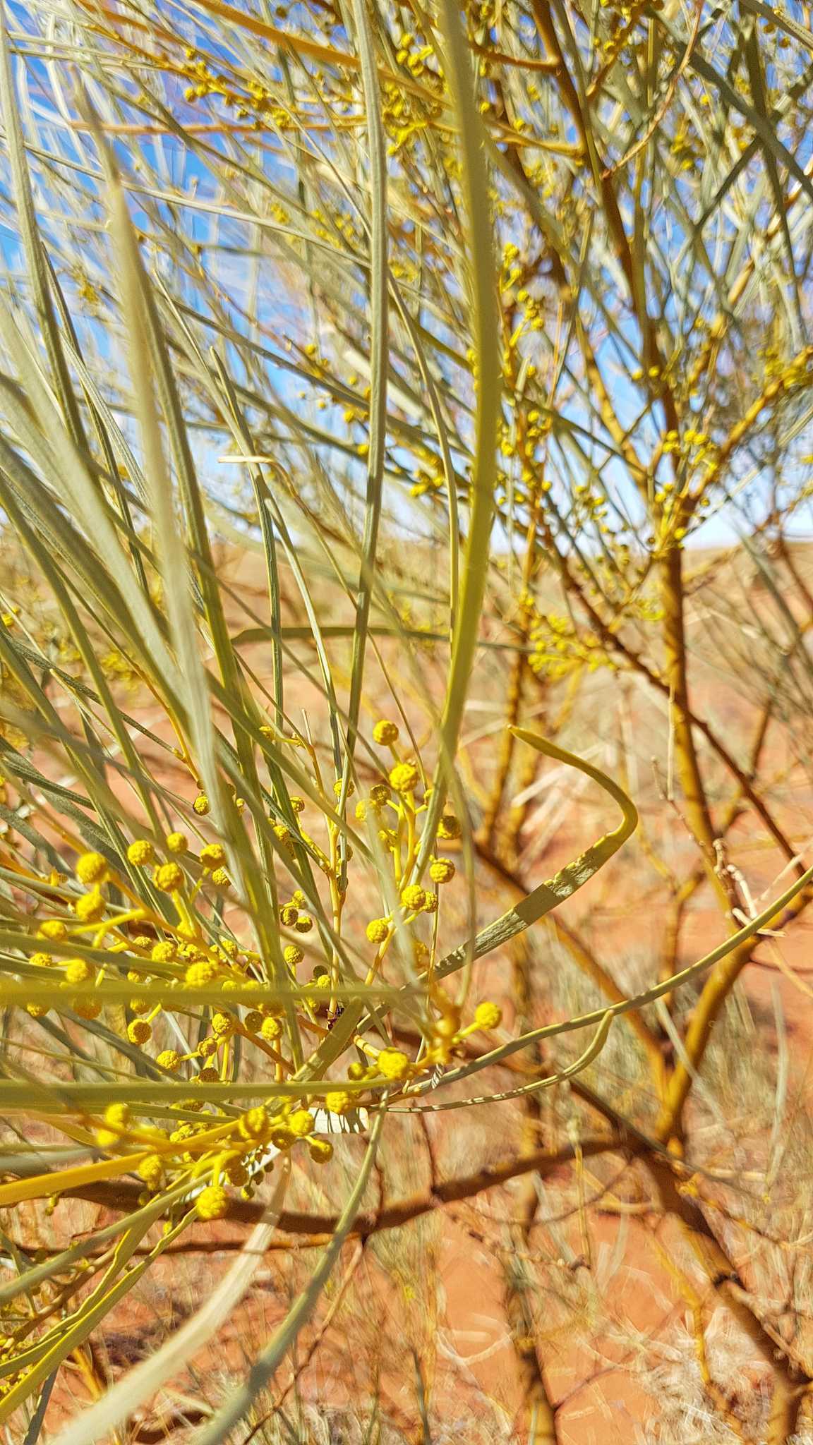
We were blessed with prolific wildflowers and flowering stands of Gidgee trees.
Camp 11 has quite a collection of logbooks, "I've been here" tags and mementos from many visitors.
We ended up camping there the night, then discovered some nice trees and wood just over the next few dunes :(
Camps 12-16 took us 2 days.
At Camp 16 we placed our plaque next to everyone else's and turned off the Hay River Track, towards camp 17.
Camped fo the night between 17 and 18..then it was off on a big day to Birdsville.
Not visiting camps 23 & 24 as they are on private land.
The clouds were starting to gather and we needed showers, so It was off to Birdsville for a bit of luxury.
As usual..the QAA was in bad condition, with side tracks veering off the track and around the badly eroded/ damaged sections.
No problems for our TVans.
We got to Big Red, just on dark, but we didn't want to miss out on another big dune...The tyres were still down, so we took it on in the dark. After carefully picking our lines, we made it up without banging, spinning or getting bogged...Love the TVans..they travelled so well behind us...in fact...we forgot they were there, as you never feel any tugging and jumping from our "passenger"
Whilst now a very defined track, The Madigan is a great trip.
Some dunes show signs of "abuse", but no where near as bad as those on the QAA.
The colours and scenery were spectacular. The desert benefitted from rain in the recent months and bloomed beautifully.
In my notes and pics above, you will note that camp 11 pics have located themselves a lot earlier on in the track notes
Our total trip was over 5000ks, however only my waypoints for the Madigan are all intact!