_250x250_cropped.JPG)
September 30, 2018
September 14, 2018
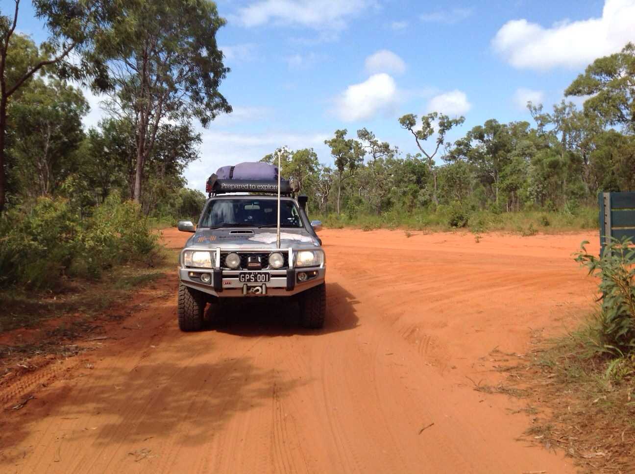
2018 Midweek NSW Explore Trip (web)
1049 kmTrip Stats:
Vehicle: '95 LR Defender 110 Tdi300 Wgn
Distance: 1123kms
Time Frame: 3 days
Economy: 11.8ltrs/100kms
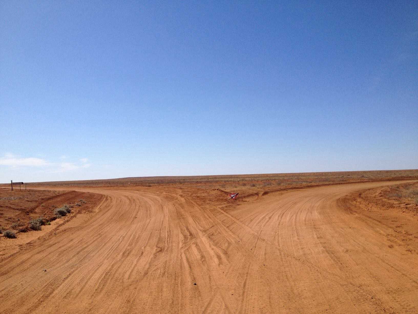
Day.1 (363kms / DT:7h22min):
Headed off around 7am and made my way down to Beaudesert for Breaky, then continued down through Rathdowney; Woodenbong and Urbanville where I turned sth along Paddys Flat Road. Came to a nice little river crossing called Billy Mays Point. I could driven across the normal way over the bridge but where's the fun in that, so I took the little side track through the river. Continued until I reached another spot I had come across in a previous trip - Paddys Flat Comping along the Clarence River (near where the Cataract River meets). Some nice little free spots here to camp as well. Drove around checking the area out for future camping. Came across someone's camping gear that they either had left behind or it may have been left for some hikers....
Continued along until a reached Sugarbag Rd which I turned onto. There was a No Through Road sign that I past which concerned me as the map I had showed it continuing through to Drake. Wasn't long before I came to the End of the "normal" road but the road (aka track) continued. It was a nice to get offroad and I followed this road for a few kms where it popped out the other side onto another formed dirt road. Reached the little town of Drake where I came across a strange name for a Hotel "Lunatic Hotel" - can only imagine the clientele... From town I turned onto Long Gully Rd then onto Rocky River Road. This section of the road was quite windy but the scenery was great. The road followed the Timbarra River with some great camping areas along the way.
Turned off Rocky River Rd onto Upper Rocky River Rd then continued along to see how far the road went. Came to where the road crossed the river and thought it was a suitable place to turn around. As time was getting away on me, I turned around and headed back to where I had to turn off into the bush and onto my first bit of offroading - Billyrimba Trail. Nothing hard about the trail, just a bit steep, but easy. Finally made it to the top and turned onto Billyrimba Lookout Trail. This was I decided to make camp for the night.... Not a bad choice I thought.
Day.2 (283kms / DT:5h37min):
Not really knowing what the road conditions were going to be like, I packed up and headed off early to see what laid ahead.... nothing exciting at least.. Upon reaching the Gwydir Hwy, I headed NW to my next Destination for the Night - Lemontree Flat Campgrounds in the Kwiambal NP. Along the way I stopped at the following spots: Town of Emmaville; Pindari Dam; Ashford Limestone Caves; MacIntyre Falls.
Day.3 (477kms / DT:6h37min):
Final Day and the the long drive home, but not before doing a little exploring of some tracks in the local area, which lead to some hidden gems. Reached my final destination of HOME by about 3pm, giving me enough time to unpack and then plan/pack for our next trip :)
April 14, 2018
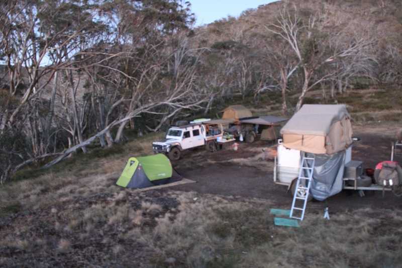
2018 Vic High Country Trip (TOTAL 4109kms)
4091 kmOn this trip there was supposed to be 3 vehicles leaving together, but due to other circumstances, they were not able to leave with us and said they would catch up with us in few days’ time, so we ended up leaving Home by ourselves @ 2.45am and made our way to our 1st stop - Goondiwindi for Breaky. When we hit the Western Fwy, I noticed that I was getting Speed Wobbles - Not a good Start to the Trip. Reached Goondiwindi in good time to refuel and have breaky at Maccies. From here we pushed onwards stopping @ Narrabri for morning Smoko. Pushed on to our 1st night’s camp - Parkes Showgrounds.
Distance & Time: 1040 kms/11hrs 37min
Up early to start D2 and headed off, noticing a bit of a squeak/squeal coming from the front of the Landy. Stopped and couldn't find anything obvious. Noticed noise disappeared when I put my foot on the clutch but couldn't understand what it might be. We decided to push on and the noise seemed to disappear at Hwy speeds. Made good Time to get to Wagga Wagga where I was to find out what squeak was to be.... I started to get a bad vibration through the steering wheel when accelerating from start. I stopped to check what I thought it might be and I was correct in my thinking - a failing Rear Uni-Joint on the Front Drive Shaft :( Made a few calls to RACQ/NRMA and got the Mechanic out to inspect what I already knew. He removed the Front Shaft for me and said nothing could be done until Tuesday due to the Public Holidays... Luckily I had 2 spare Uni-joints on board and made a call to a good Landover Mate that I trusted and he took the time to help me as much as he could over the phone in the method of replacing the Uni-joint on the side of the road by myself. I also put out a SOS on the AULRO website that I greatly appreciated at the time, knowing that there was other Landy owners willing to help us out. After quite a few hours I managed to replace the Joint and headed off to our nights camp where I planned to regrease/refit the front drive shaft back to the Landy. Reached camp and decided to try and grease the uni but without success. Again, more phone calls to my mate and posts on the SOS Aulro Post and the decision was to refit the shaft the following day and drive for a bit and then try to see if we could then get grease into the uni-joint. A few hours later, the 2nd car/family of our group of 3 cars/families arrived in time for dinner/dinner and a quick catch-up before calling it for the night.
Distance & Time: 304 kms/3hrs 40min
Early rise to continue refitting the Front Shaft with one more unsuccessful time in trying to regrease the shaft. Fitted the front shaft and packed up and heading into town to buy a few Food & auto spares (grease, grease nipples, etc.). Hit the road and headed for Beechworth to meet with a fellow Landy Owner before continuing onwards to our next stop - Myrtleford where we refuelled and headed down Buffalo River Rd to our nights camp near our turnoff into the VHC - Manna Gums Campgrounds. This is also where the 3rd vehicle/family caught up with us to make our group whole again.
Distance & Time: 260 kms/3hrs 48min
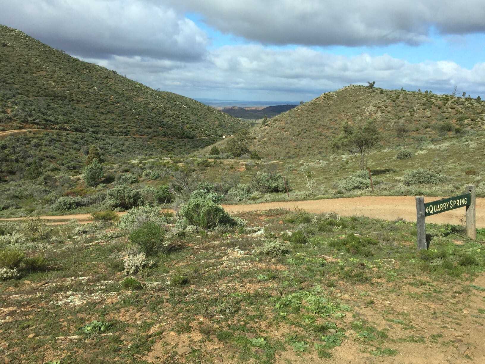
A quick pack up and a quick look over the vehicle/trailer & lowered our tyre pressures down (25psi Front & 28psi rear) before we hit our 1st VHC track - Dandongadale-Buffalo Trk. This was to be an interesting start to our VHC Trip with the track graded as a ""M"" & ""D"" by hema. The 1st few hills had me wondering if I did the right thing in bringing the trailer along as the poor old Defender really noticed the extra weight behind it. It made it up all the rocky loose hills as long as I applied a bit more right foot before hitting the harder/loose parts. Out of our group of 3 vehicles, there was only 1 that wasn't towing a trailer and we made him take the lead just in case my Defender needed a helping hand to get to the top of some of these steeper sections of the track. We followed Dandongadale-Buffalo Trk then onto Dan Buffalo Divide Trk & onto Lake Cobbler Trk, then to a apparently a ""H"" rated track Abbeyard-Lake Cobbler Trk before joining up to Lake Cobbler Rd. This section of the road is where things went wrong for the lead vehicle. A couple of young Nissan Patrol drivers came flying around the corner way too fast and couldn't stop quick enough and slid into the mates 80's Cruiser. We stopped and checked out the damage and he exchanged vehicle details before they continued off - still at their high speed, obviously they hadn't learnt their lesson.... The damage wasn't too bad but would result in a new B/Bar and possible new bonnet/guard. We made it to Lake Cobbler to rest a bit and calm the nerves and grab a bite to eat before continuing our way to our night’s camp along King River/Hut. The road down into the King River Hut was slow going with the trailers on as it was quite rocky and loose. Made it to camp with daylight to spare, so the decision was to made to help make up for lost time was to head out and do the circuit drive to ""Craig’
2018VHCTrip (125).JPG
September 15, 2020
Created:
June 02, 2016
Karajarri Protected Area - Visitors Permit
87.4 kmThe Karajarri Protected Area Visitors Permit is for people wishing to visit and explore Mirntanymartaji and Purnturrpurnturr Country (the Port Smith and Gourdon Bay area). All visitors to these areas enter and travel at their own risk. You should ensure that you are adequately prepared.
A permit will only be issued once it has been paid for. It is valid for the vehicle, number of persons, destinations and time period indicated on the permit. The standard fees are:
$10.00 for a day permit
$15.00 for a weekend permit (includes long weekends)
$40.00 for a week permit (7 days)
$80.00 for an annual permit (starting from first date)
Please visit http://www.karajarriprotectedarea.com/Default.aspx to apply for a permit
March 16, 2018
Created:
October 29, 2014
Lyndhurst to Cameron Corner 29/10/14
432.4 kmDay 16 Alice Springs Trip
Lyndhurst Hotel campground to Cameron Corner Store. Strzelecki Track mostly fast dirt with small sections of bitumen at creek crossings etc
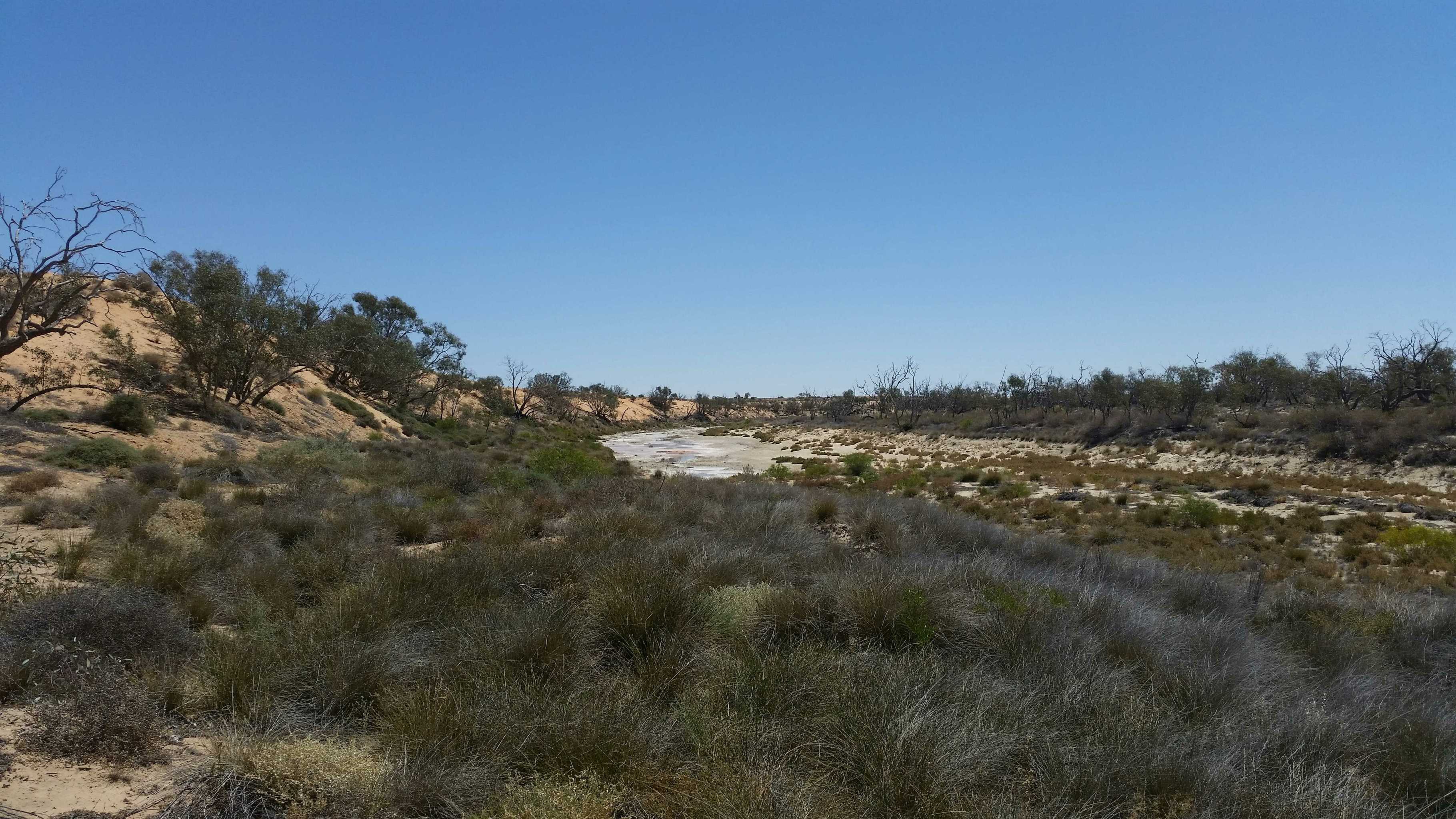
Yaninguri Waterhole
August 31, 2017
Created:
August 11, 2017
Geo Centre and Geosurveyors Hill 27/07/2017 12:18:51 PM
3357 kmWell..we did it too!
Vehicles:
Us: ’06 100 series TDA Toyota Landcruiser
Our follower was our 2012 Track Trailer Tvan
My brother: 2015 200 series TDA Landcruiser
Our route:
Coober Pedy..
Kulgera…
Old Andado Station…
Mac Clarke Reserve
Madigan Camps 1, 1a and 2
Colson Track
..cross country to:
Geosurveyor’s Hill
Cross country again to:
The Geographical Centre of the Simpson Desert
Then:
Cross country again (a defined track now!)
French Line
Knolls Track
Rig Road
Warburton Track
Birdsville Track
For all the detail geeks out there, I’ve put down some facts and figures for you.
Day 1
After John rested from a serious bout of “man flue”, we left Coober Pedy and headed to Kulgera
Distance: 410kms.. Fuel: 134 Litres… Price: $1.50/l 17 L/100
Tyres: F. 30lb B. 35 Tvan. 24
Our first camp was just out of Kulgera by a dry creek bed.
Bogan fleas (nasty prickles) everywhere, but good, plentiful wood.
Day 2
From Kulgera to west of Mac Clarke reserve, Via Old Andado Station.
Distance: 280km from Kulgera
Camped off the road between Old Andado and Mac Clarke Reserve
Day 3
To Mac Clarke Reserve, Madigan Camps 1, 1a &2, to The Colson Track.
40kms from the Madigan/ Colson track intersection, to our turn off to Geosurveyor’s Hill.
We photographed and passed all the obligatory abandoned fuel / oil drums shot line pegs and “points of interest”
Distance: 400km From Kulgera
There were some serious dunes which required a wide range of tyre pressures throughout the day.
We rocked, rolled, landscaped dunes, inflated and deflated our tyres all day
Tyre pressures were ranging from: F 25lb … B 32 lb …Tvan: 18
TO F 12 lb … B 17 lb … Tvan 12 lb
We only managed 60 kms that day…
Day 4 460 kms from Kulgera
We put 40 litres of fuel in the car..from our total of 60 l we were carrying in the Tvan. (keeping 20 portable litres as a reserve supply) We were following some very vague tyre impressions once we left the Colson, which disappeared on a few occasions. Overall, the 1 month old route we followed was visible enough.With some crazy dune approaches, sharp twists and turns of the faded track, we sometimes decided there was a better route up the dunes.There wasn’t any flat ground on this section of the track, so when we climbed a difficult dune, we decided it was the best spot to stay for the night!!!!We only did 32kms that day. Once again, looking at and photographing all the obligatory fuel dumps and drums…and the odd action shot of our “duning”
Not once did we get bogged, or lose traction. We picked up shovels..filled in some holes and tyre abuse on the track we were to climb, dropped our tyre pressures and got up without any trouble.
Day 5 492 kms from Kulgera
Started our tyre pressures that day at: F. 16 …B. 22…Tvan 12
Some really big dunes and a fair bit of landscaping today.We only managed 40kms that day, averaging 4km/hour.Some of the tracks we were following began to really wobble around and over the dunes, so a few better selections were taken that day again tooWe sighted the pimple in the distance from atop of a large dune and headed for the prize.Enjoying a beverage on top of Geosurveyor’s Hill and taking the obligatory photoshoot, we sighed and headed south!
Our camp was south of Geo SH
Day 6 531kms From Kulgera
Tyres: F 13 lb…R 19 lb…Tvan 12 lb
Heading south To the Geocentre today..lots of dune crossings , some W-E..a few switching back E-W. We only managed 68kms today.We thought it would be easier now that we were heading south..not really. The faint tracks were off in a different direction once we had left GSH, so we followed a bit more used track.Once again, a few routes previous travellers had taken, were a little “unusual” and not the easiest route they could have taken..so we made a couple of small side tracks. We reached the Geocentre, signed the book, looked at the tower and it’s ornaments and took the obligatory pictures……And sighed again!....We followed a now well-defined track, which ran along and top of the edge of the dunes. We made camp, where there was a flat spot AND some wood!
Day 7 599kms from Kulgera
We put in a big day today.One particularly obscure dune approach needed a serious reconsideration.With no room to position ourselves to cross this dune and no inclinations to re position the whole dune, we cleared and smoothed out another approach, which we climbed easily.This dune was more obnoxious though. It had yet another level to scale.So John did a loop on the lower level of the dune and once again, took a straighter route up the final distance.
Tyres down to: F 12…B 18…Tvan 12
Over this dune was a grove of gidgee trees, where John re- inflated the tyres a little.
By now, we were on the home run to the French Line.
My brother had headed south east (just left of the track we were following), to see if he could find a better way.At one point, we got a little “lost”, but discovered a fuel drum lying along a shot line on top of another dune. Of course..photographed it!
Eventually we both met up
20170803_105449.jpg
February 05, 2016
Created:
June 09, 2015
February 05, 2016
Created:
June 11, 2015
Geo Centre - Birdsville, June 2015
208.1 kmThe Geographical Centre of the Simpson Desert was officially marked by the CFA 4WD Club with David & Joan Owen and Rob & Dot Correa in 1993. In 1995 David & Joan Owen, Rob & Dot Correa and Geoffrey Owen erected the tower to identify the Geo Centre. It has 2 x VW hub caps on the top and can now be seen by planes flying over. This trip was to conducted by David & Joan Owen (Aussie Tracks) with Trevor & Stephanie Owen and David & Cheryl Sidebottom to celebrate the 20th anniversary of the erecting of the tower.

My Photo - 12/06/2015 8:25:03am
January 15, 2016
Created:
August 05, 2015
September 07, 2015
Created:
May 06, 2015
Offroad Adventure Show Episode 1 Coffs Harbour
92.2 kmFollow the team from the Offroad Adventure Show through Coffs Harbour. Including the Woopi Trail, Wahoo Trig Lookout, The Keyman and a great camp at Pebbley Beach.
My Photo - 8/05/2015 6:56:11am
May 18, 2015
Created:
June 01, 2014
Hema - Old Telegraph Track North
29.0 kmHEMA CAPE YORK ATLAS & GUIDE - TRACK #11
This track requires low range and high ground clearance in addition to appropriate traction aids. Driving from the turnoff to Fruit Bat Falls, we took the Mistake Creek turnoff to the Northern Bypass Road to avoid a swollen Nolan's Brook.
This is Track #11 from our Cape York Atlas & Guide, which you can purchase online here: http://bit.ly/capeguide