June 02, 2014
Hema - Bamaga to Pajinka (The Tip)
66.5 kmHEMA CAPE YORK ATLAS & GUIDE - TRACK #15
This trip from Bamaga to The Tip (the northernmost point on the Australian mainland) requires low range and high ground clearance, with the most difficult section coming on the return drive towards Punsand Bay, which can become impassable when wet.
This is Track #15 in Hema's Cape York Atlas & Guide, which you can purchase online here: http://bit.ly/capeguide
May 27, 2014
Hema - Bloomfield Track
168.6 kmHEMA CAPE YORK - MOSSMAN TO COOKTOWN
The Bloomfield Track is relatively simple to negotiate in comparison to many of Cape York's tracks, though after heavy rain the track was interesting and landslips were not uncommon.
For more information on the Bloomfield Track, consult Hema's Cape York Atlas & Guide, which you can buy online here: http://bit.ly/capeguide
June 03, 2016
Created:
November 04, 2015
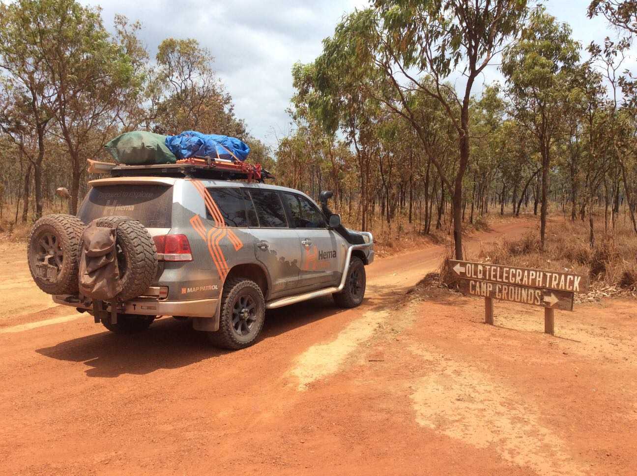
Hema - Old Telegraph Track South
94.2 kmFOR MORE INFORMATION ON THIS TRACK, PLEASE REFER TO OUR CAPE YORK ATLAS & GUIDE: http://bit.ly/capeguide
GRADING: This track requires low range, high ground clearance, traction aids and recovery gear, and contains deep creek crossings and slippery, steep river banks.
THE DRIVE: The southern section of the Old Telegraph Track can take one to two days, depending on your personal preference and the OTT's seasonal track conditions. The first major obstacle is Palm Creek, followed by Ducie Creek, Dulhunty River, Bertie Creek, Gunshot, Cockatoo Creek and Sailor Creek - leaving little wonder as to why it's one of Australia's most famed tracks. Palm Creek and Gunshot are the most challenging crossings, while the Dulhunty offers plenty of swimming opportunities before ending the track at Fruit Bat Falls.