November 07, 2015
Hema - The Tip of Cape York (East Coast)
46.9 kmFOR MORE INFORMATION ON THIS TRACK, PLEASE REFER TO OUR CAPE YORK ATLAS & GUIDE: http://bit.ly/capeguide
GRADING: This track requires low range and high ground clearance.
THE DRIVE: This trip usually takes two days, running from Seisa to the Tip's east coast. Stop in at the Croc Tent on the way to the Somerset ruins before heading to Nanthau Beach via Fly Point and Vallack Point.
Somerset was one of the earliest settlements on the Cape, established in 1864. John Jardine was placed in charge of the settlement, and after an epic 10-month cattle drive from Rockhampton to Somerset, his son Frank Jardine would continue the family connection to this settlement until 1873.
November 05, 2015
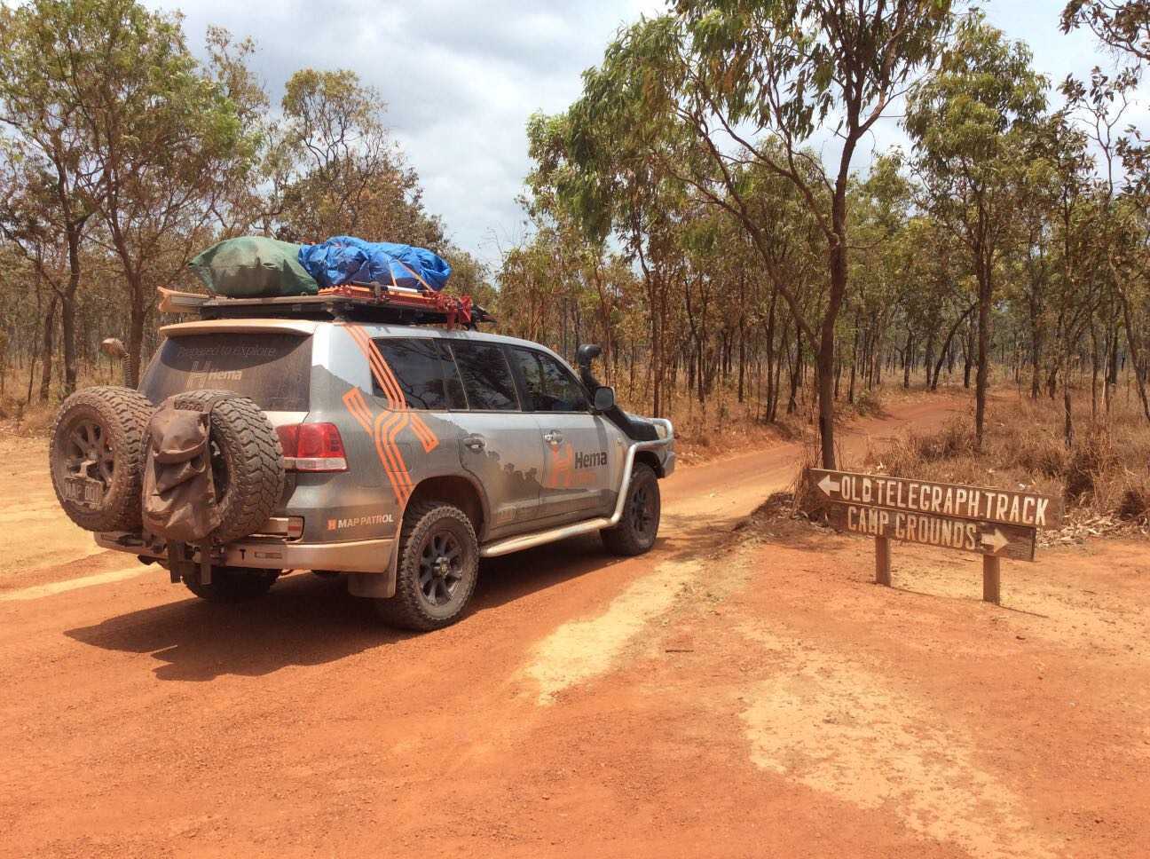
Hema - Old Telegraph Track North
86.4 kmFOR MORE INFORMATION ON THIS TRACK, PLEASE REFER TO OUR CAPE YORK ATLAS & GUIDE: http://bit.ly/capeguide
GRADING: This track requires low range, high ground clearance, traction aids and recovery gear.
THE DRIVE: The northern section of Cape York's Old Telegraph Track runs from Bamaga Road to the Jardine River Ferry. Fruit Bat Falls is a must-visit detour to the right at the beginning of the track. After this point, the track runs straight until the turnoff for Eliot, Twin and Indian Head Falls, after which comes Canal Creek. This section of the track is one of the best parts of Cape York, with the waterfalls making an ideal photographic and swim spot, and Canal Creek offers a clear, deep blue crossing that winds to the left to avoid the washed out gullies of the old exit to the right. After Canal is Sam Creek, then the more difficult Mistake Creek, followed by the reasonably simple Cannibal Creek crossing. From here is a long drive to the biggest obstacle south of the Jardine: Nolan's Brook. After Nolan's, the track continues north to the old Jardine River ford, or the turnoff to the Bamaga Rd to catch the Jardine Ferry.
November 04, 2015
Hema - Old Telegraph Track South
94.2 kmFOR MORE INFORMATION ON THIS TRACK, PLEASE REFER TO OUR CAPE YORK ATLAS & GUIDE: http://bit.ly/capeguide
GRADING: This track requires low range, high ground clearance, traction aids and recovery gear, and contains deep creek crossings and slippery, steep river banks.
THE DRIVE: The southern section of the Old Telegraph Track can take one to two days, depending on your personal preference and the OTT's seasonal track conditions. The first major obstacle is Palm Creek, followed by Ducie Creek, Dulhunty River, Bertie Creek, Gunshot, Cockatoo Creek and Sailor Creek - leaving little wonder as to why it's one of Australia's most famed tracks. Palm Creek and Gunshot are the most challenging crossings, while the Dulhunty offers plenty of swimming opportunities before ending the track at Fruit Bat Falls.
November 02, 2015
Hema - Frenchmans Track
75.9 kmFOR MORE INFORMATION ON THIS TRACK, PLEASE REFER TO OUR CAPE YORK ATLAS & GUIDE: http://bit.ly/capeguide
GRADING: This track requires low range, high ground clearance, traction aids and recovery gear.
THE DRIVE: Ideal as either a day trip or overnighter, Frenchmans Track is a challenging and scenic track that is rife with stony and slippery surfaces, steep grades and deep river crossings. It is worth combining this trip with a drive out to Kutini Payamu National Park.
November 01, 2015
Hema - Kutini-Payamu (Iron Range) National Park
178.0 kmFOR MORE INFORMATION ON THIS TRACK, PLEASE REFER TO OUR CAPE YORK ATLAS & GUIDE: http://bit.ly/capeguide
GRADING: As far as tracks throughout Cape York go, the trip to Kutini-Payamu is straightforward, only requiring AWD more often than not.
THE DRIVE: The drive isn't a difficult one, other than some creek crossings that can be rocky. It's worth taking a walk around the Batavia Gold Mine ruins, and spending some time camping at Rainforest, Gordon Creek, Cooks Hut and Chili Beach.
October 30, 2015
Hema - Palmer River Goldfields
156.8 kmFOR MORE INFORMATION ON THIS TRACK, PLEASE REFER TO OUR CAPE YORK ATLAS & GUIDE: http://bit.ly/capeguide
GRADING: This track requires low range and high ground clearance, with steep-banked dry creek crossings.
THE DRIVE: The track begins on the Peninsula Development Road (PDR) just north of Laura, with a large sign for Jowalbinna marking the turn. The track heads through open woodlands, which are broken by sandstone escarpments carved by water and wind. There are plenty of steep grades, rough surfaces and rock steps on offer throughout, which makes this one of Cape York's most epic and more traditional tracks.
June 07, 2014
Hema - Musgrave Roadhouse to Marina Plains [Rinyirru (Lakefield) National Park]
109.6 kmHEMA CAPE YORK - MUSGRAVE ROADHOUSE TO RINYIRRU
Driving from Musgrave Roadhouse into Rinyirru (Lakefield) National Park before a water-induced road closure stopped our progress. This track links up with Rinyirru (Lakefield) National Park Part 1, which runs from Laura to Kalpowar.
Rinyirru (Lakefield) National Park is an explorer's paradise, with barramundi fishing aplenty and many tracks and attractions to visit throughout.
This is Track #5 (in part) in Hema's Cape York Atlas & Guide, which you can purchase online here: http://bit.ly/capeguide
June 05, 2014
Hema - Chili Beach to Archer River Roadhouse [Kutini-Payamu (Iron Range) National Park]
188.6 kmHEMA CAPE YORK ATLAS & GUIDE - TRACK #8
The overnight return trip from Archer River Roadhouse to Cape Weymouth is not a challenge when dry, but the drive into Kutini-Payamu (Iron Range) National Park can become difficult after rain. This return trip was from Portland Roads to Cape Weymouth and Chili Beach, down to Lockhart River and back along Portland Roads before meeting again with the Peninsula Developmental Road.
Kutini-Payamu is home to the largest remaining area of lowland rainforest in Australia, making the drive into the park a scenic one.
This is Track #8 in Hema's Cape York Atlas & Guide, which you can purchase online here: http://bit.ly/capeguide
June 05, 2014
Hema - Portland Roads [Kutini-Payamu (Iron Range) National Park]
147.6 kmHEMA CAPE YORK ATLAS & GUIDE - TRACK #8
This overnight trip is not a challenge when dry, but the drive into Kutini-Payamu (Iron Range) National Park can become difficult after rain. It's a popular choice to deviate before reaching Portland Roads to head to Cape Weymouth and Chili Beach, while on the return route the offshoot that meets with Frenchmans Track is an adventurous alternative to come back.
Kutini-Payamu is home to the largest remaining area of lowland rainforest in Australia, making the drive into the park a scenic one.
This is Track #8 in Hema's Cape York Atlas & Guide, which you can purchase online here: http://bit.ly/capeguide
June 03, 2016
Created:
November 04, 2015
Hema - Old Telegraph Track South
94.2 kmFOR MORE INFORMATION ON THIS TRACK, PLEASE REFER TO OUR CAPE YORK ATLAS & GUIDE: http://bit.ly/capeguide
GRADING: This track requires low range, high ground clearance, traction aids and recovery gear, and contains deep creek crossings and slippery, steep river banks.
THE DRIVE: The southern section of the Old Telegraph Track can take one to two days, depending on your personal preference and the OTT's seasonal track conditions. The first major obstacle is Palm Creek, followed by Ducie Creek, Dulhunty River, Bertie Creek, Gunshot, Cockatoo Creek and Sailor Creek - leaving little wonder as to why it's one of Australia's most famed tracks. Palm Creek and Gunshot are the most challenging crossings, while the Dulhunty offers plenty of swimming opportunities before ending the track at Fruit Bat Falls.