


September 12, 2015
Hema Explorer - Map Patrol Cherry-Williams
176.6 kmThis trail is a Northern section of the Arizona Traverse spanning from the town of Cherry Arizona to Williams Arizona. It covers 110 miles of forest road and includes a diverse array of plant and animal life thanks to the sizable gain in elevation. We recommend two to three days to fully appreciate the track and enjoy the views and towns along the way.
The drive begins In the high plains with long views, grass, and shrubbery. Winding your way up and down the Mingus mountain range you'll quickly transition to high desert with pine and other types of trees. There are plenty of back roads to explore in these mountains so be sure to take a look if you have the time. When you reach the top of the range a paved road will take you down to the town of Jerome where we highly recommends topping for a bite to eat and looking around. It's a cool city with a unique local flare. When you're ready turn out the west end of town toward the ghost town and you'll pick up a dirt road towards Perkinsville. This section is fast and pretty but be sure to watch for oncoming traffic as many corners are blind and there's a large drop off the side. The road gets bumpy from here and slowly leads up into the mountains. Temperatures drop here and the vegetation changes once again. We recommend camping once you've crossed back into the pine trees and the road turns to a red dirt. Most of the good camping is found in this region, especially if you have ground tents. From here the roads get smooth and the views continue to stun. Enjoy the journey!
My Photo - 9/12/15, 10:40:46AM
July 28, 2015
Hema Explorer - Map Patrol Imogene Pass
30.7 kmImogene pass is a beautiful track which runs between the towns of Ouray Colorado and Telluride Colorado. It happens to be the second highest pass in the state and reaches an altitude of 13,114 feet or 3,997 m at its crest. Although the majority of the trail is easy, one or two obstacles can pose a challenge to vehicles without high clearance. We recommend running the trail from west to east to make the main obstacles easier.
The drive has plenty to offer for adventurous drivers. In terms of scenery you'll witness snow covered peaks, crystal clear streams and lakes, large pine trees, and stunning wildlife. You will be challenged by several small water crossings, climbing and descending ledges, and traversing tight switch backs on both sides of the mountain.
Despite the relatively easy road conditions, extreme caution must be used. High cliffs and often slick surfaces can spell danger for touring motorists. Drivers must stop their vehicles if they wish to enjoy the view. Even a few seconds with your eyes off the road is enough to leave the narrow track and take a crushing tumble down the cliffs.
Imogene is only passable during brief periods of the summer, being covered by dense snow and ice the remainder of the year. Do not attempt under any circumstances to cross in winter conditions.
My Photo - 7/28/15, 2:47:36PM
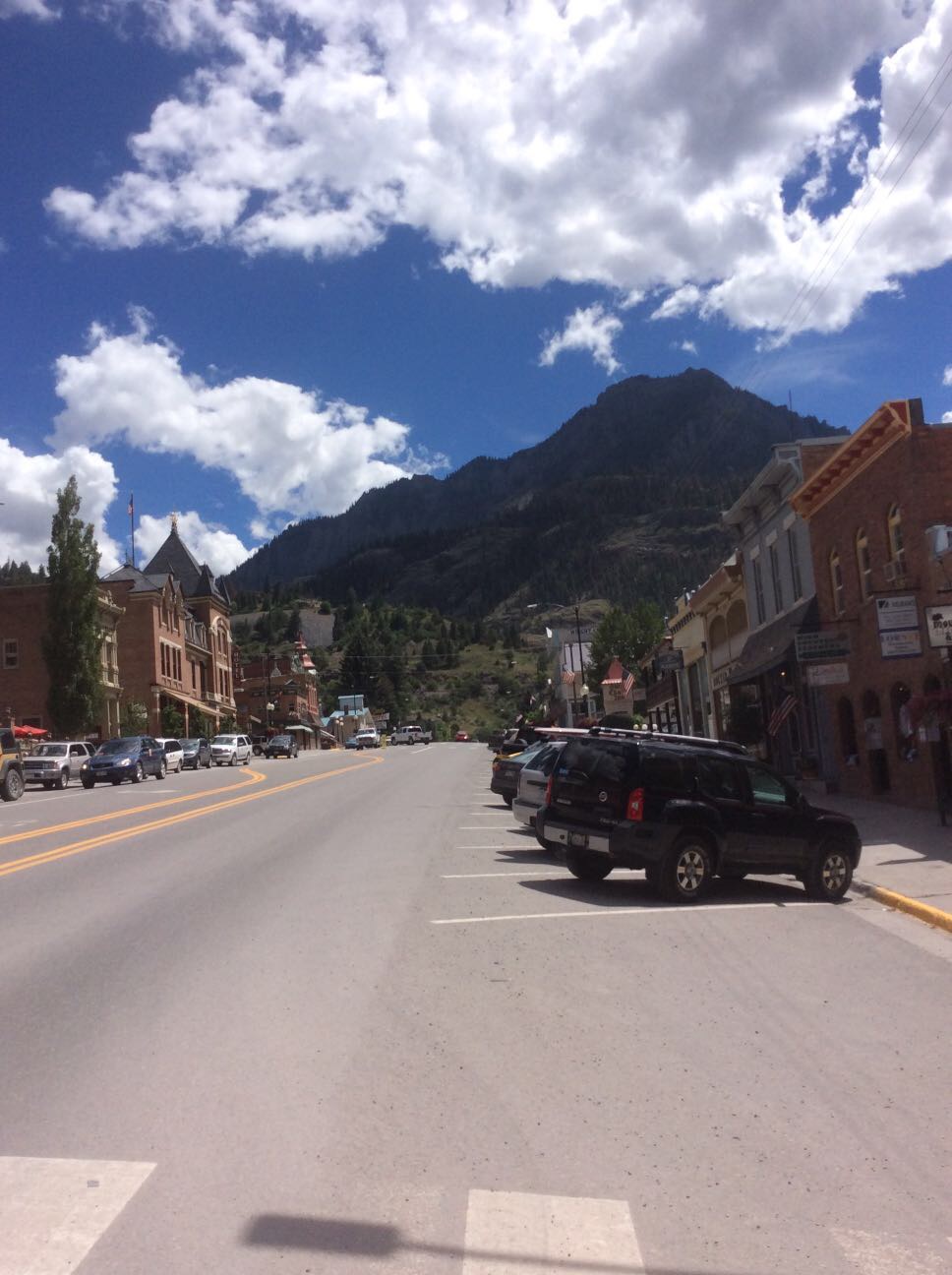
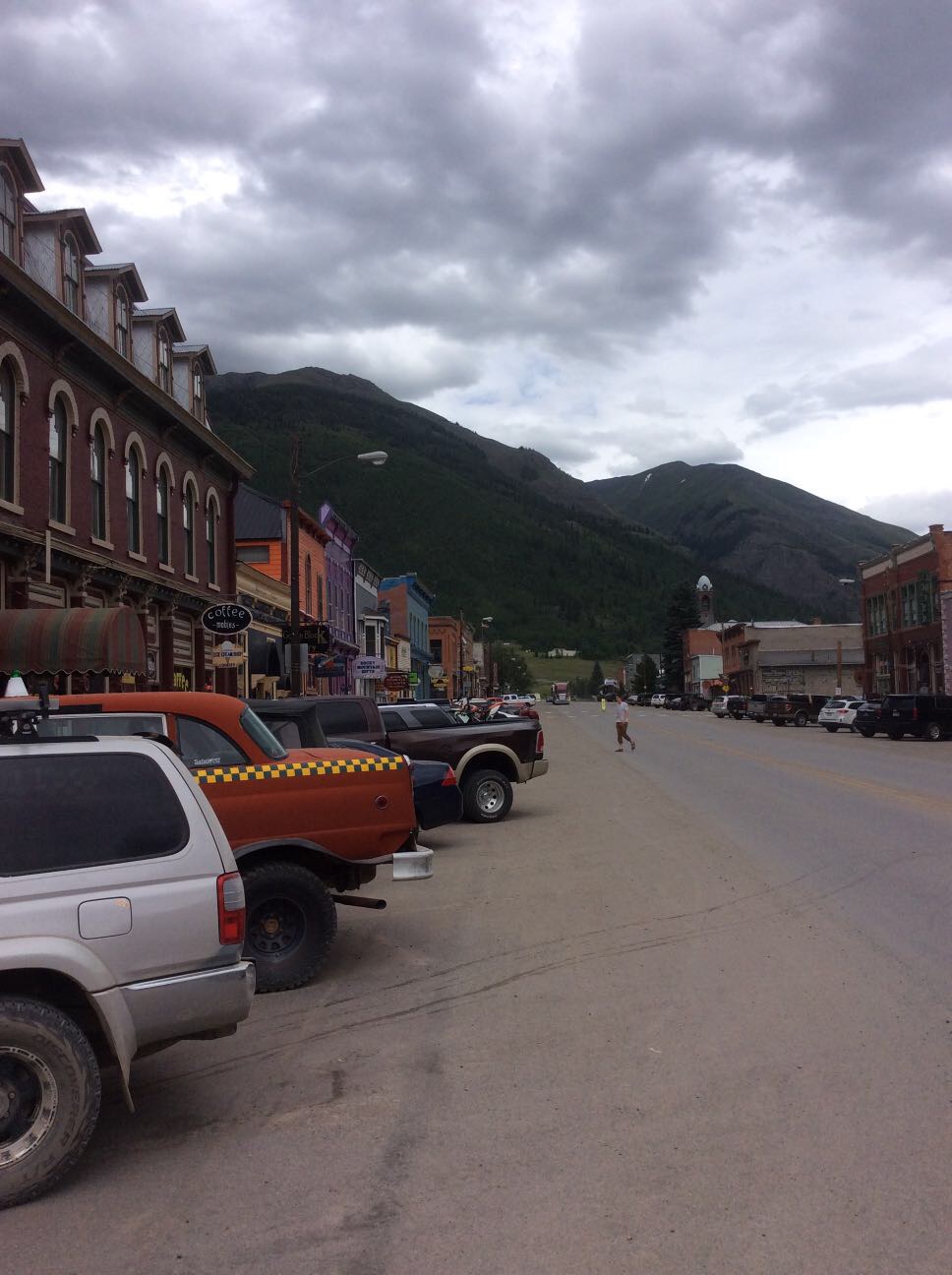
July 26, 2015
Hema Explorer - Map Patrol Alpine Loop
109.0 kmOur trip through the alpine loop was 70 miles through some of Colorado's most beautiful countryside. Scenic vistas, mountain passes, clear flowing streams, and varied wildlife are abundant along this route and every corner will reveal a new surprise. The trail came to prominence in the late 1800's when miners came in search of silver, gold, and ore. Needing a way to transport supplies and minerals via horse cart, they cut large paths through the mountains from Silverton to Lake City and finally to Ouray Coloarado. In many places signs of the mining rush still exist, from old bridges to buildings and even equipment that was left in place to rot away. Today these tracks are largely used by bikes and four-wheel drives and include some favorites like Cinnamon and Engineer Pass.
Though many parts of this loop are fast well maintained forest roads, there are sections which require low range and careful driving. Above all the roads are narrow and taking even a moment to look away can spell disaster.
Flora and fauna can range drastically in the alpine environment and it is all beautiful. Conifer, pine, and deciduous trees, wildflowers, shrubs, mushrooms, mosses, and lichens all have a strong presence in the area. Fauna include many species of bird, fish, goat, large cat, and of course bears. Caution should be used when camping along the loop to avoid attracting large predators. Be sure to contact local park rangers for more information on what to do around bears and large cats.
This track is not passable during many portions of the year and we recommend going from mid June up until the first snow of the year.. Always contact the local forest service for current road conditions and do not attempt if freezing conditions or snow are present on the trail.
My Photo - 7/26/15, 4:29:18PM
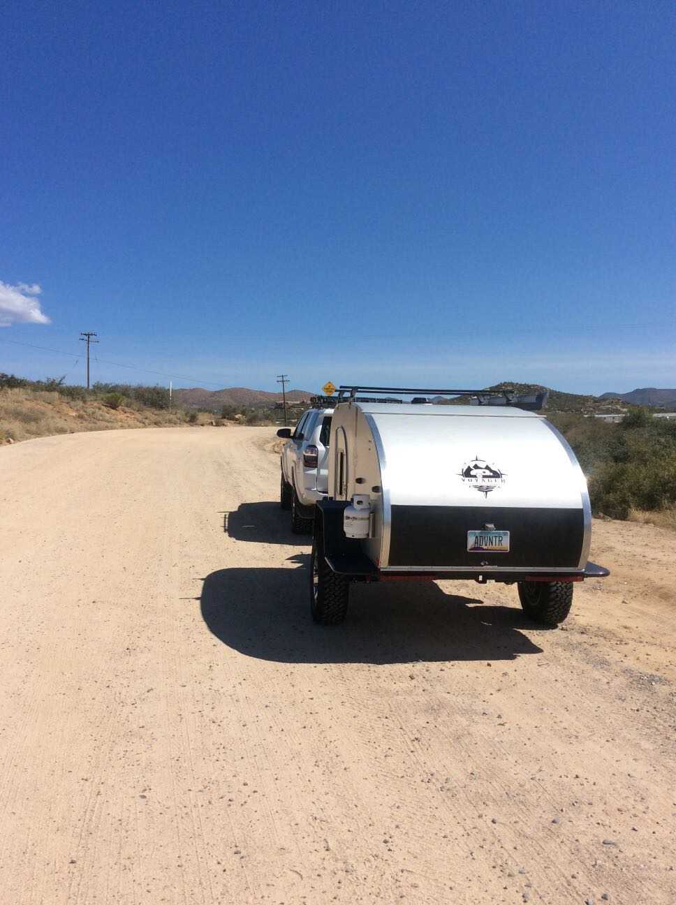
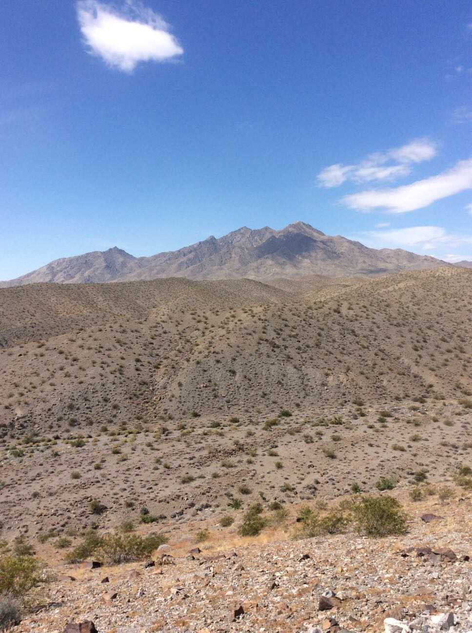
May 22, 2015
Hema Explorer - Map Patrol Mojave Road
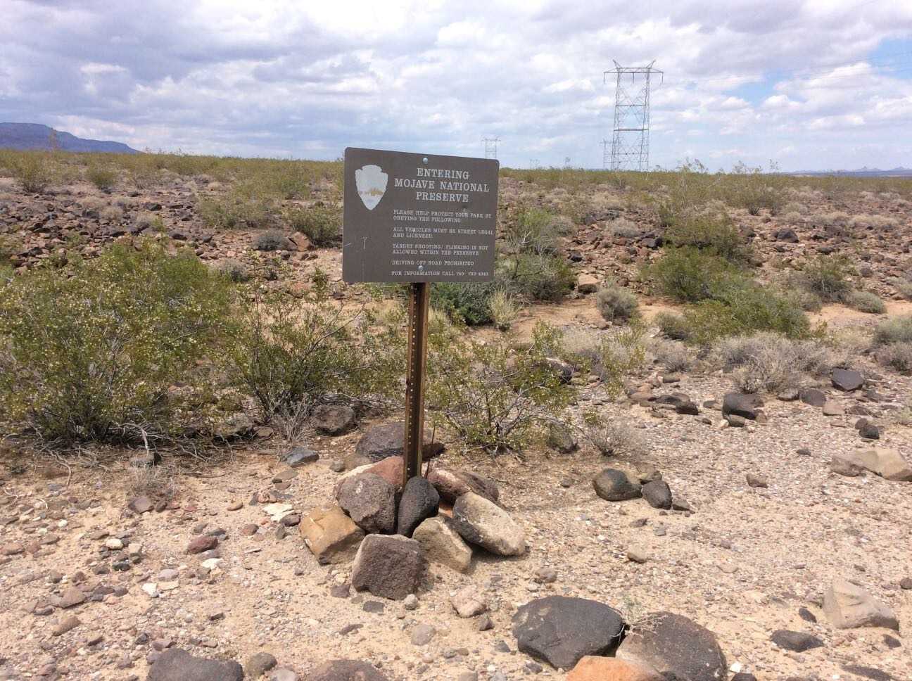
356.2 kmThe Mojave Road traverses 140 miles of the Mojave National Preserve. Though not exceptionally technical, the remote water-less expanses, historical nature, and impressive topography have made this a classic overland track. We've added on to this scenic route to lengthen the trip and include a secluded beach camp site where travelers may escape the desert heat. The trail includes large sand washes, dry lake beds, heavy silt, steep ascents and descents, and cross-axle hills requiring low-range and careful tire placement.
Flora includes the unique Joshua Tree which appears as something out of a doctor Seuss book, yucca plants, cacti, creosote, and other plants typical of the desert southwest. Fauna ranges widely from owls, small mice, and rodent, to reptiles like gila monsters tortoise and chuckwalla, up to larger predators like cougars.
If you plan to traverse the route, we highly recommend coupling this GPS track with the Mojave Road Guide by Dennis Casebier. It gives an excellent overview of the trails history and provides interesting information along the way.
The track can be completed without refueling if you plan accordingly, however the town of Baker can be the perfect spot to hop off the trail, fill the tanks, and grab a cold drink to escape the heat. There is little to no support along the trail so be sure to bring food, water, a spare tire, and appropriate medical supplies for safety. A spot device or sat phone is recommended.
My Photo - 5/23/15, 9:55:05AM
May 22, 2015
Hema Explorer - Map Patrol Mojave Road
The Mojave Road traverses 140 miles of the Mojave National Preserve. Though not exceptionally technical, the remote water-less expanses, historical nature, and impressive topography have made this a classic overland track. We've added on to this scenic route to lengthen the trip and include a secluded beach camp site where travelers may escape the desert heat. The trail includes large sand washes, dry lake beds, heavy silt, steep ascents and descents, and cross-axle hills requiring low-range and careful tire placement.
Flora includes the unique Joshua Tree which appears as something out of a doctor Seuss book, yucca plants, cacti, creosote, and other plants typical of the desert southwest. Fauna ranges widely from owls, small mice, and rodent, to reptiles like gila monsters tortoise and chuckwalla, up to larger predators like cougars.
If you plan to traverse the route, we highly recommend coupling this GPS track with the Mojave Road Guide by Dennis Casebier. It gives an excellent overview of the trails history and provides interesting information along the way.
The track can be completed without refueling if you plan accordingly, however the town of Baker can be the perfect spot to hop off the trail, fill the tanks, and grab a cold drink to escape the heat. There is little to no support along the trail so be sure to bring food, water, a spare tire, and appropriate medical supplies for safety. A spot device or sat phone is recommended.
My Photo - 5/23/15, 2:14:22PM
May 11, 2016
Created:
May 22, 2015
Hema Explorer - Map Patrol Mojave Road
356.2 kmThe Mojave Road traverses 140 miles of the Mojave National Preserve. Though not exceptionally technical, the remote water-less expanses, historical nature, and impressive topography have made this a classic overland track. We've added on to this scenic route to lengthen the trip and include a secluded beach camp site where travelers may escape the desert heat. The trail includes large sand washes, dry lake beds, heavy silt, steep ascents and descents, and cross-axle hills requiring low-range and careful tire placement.
Flora includes the unique Joshua Tree which appears as something out of a doctor Seuss book, yucca plants, cacti, creosote, and other plants typical of the desert southwest. Fauna ranges widely from owls, small mice, and rodent, to reptiles like gila monsters tortoise and chuckwalla, up to larger predators like cougars.
If you plan to traverse the route, we highly recommend coupling this GPS track with the Mojave Road Guide by Dennis Casebier. It gives an excellent overview of the trails history and provides interesting information along the way.
The track can be completed without refueling if you plan accordingly, however the town of Baker can be the perfect spot to hop off the trail, fill the tanks, and grab a cold drink to escape the heat. There is little to no support along the trail so be sure to bring food, water, a spare tire, and appropriate medical supplies for safety. A spot device or sat phone is recommended.