November 12, 2015
Ophir Pass (Easy)
15.9 kmTrail time: 1-3 hours
This trail is fairly easy though you spend a lot of time on a shelf road. The road is usually narrow so if you have to pass someone it could be difficult and dangerous. The trail connects Telluride and Silverton and is very scenic. The Black Bear Pass and Imogene Pass trail runs will return from Teluride over Ophir Pass. Ophir Pass is also a good choice to make a loop to Teluride with Last Dollar Road.
GeotagMyPic
November 12, 2015
Red Mountain Mining Area (Easy) (Unofficial)
14.6 kmThis is not an organized trail run at the FJ Summit.
November 12, 2015
Last Dollar Road (Easy) (Unofficial)
29.7 kmThis is not an organized trail run at the FJ Summit.
Trail time: 2-3 hours
This road was originally an early supply route from Ouray to Telluride. This extremely easy road traverses through picturesque ranches, passes through beautiful aspen forests, and provides scenic views of the San Miguel canyon as you wind your way to Telluride. Beautiful in the fall with its amber colored aspen stands.
November 12, 2015
November 12, 2015
Box Factory Park (Easy) (Unofficial)
11.6 kmThis is not an organized trail run at the FJ Summit.
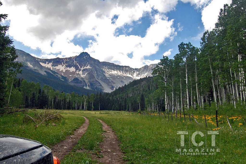
MeadowAtEnd.jpg
November 12, 2015
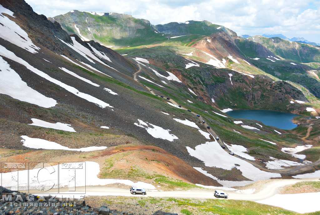
Corkscrew Gulch (Easy)
11.4 kmTrail time: 4-6 hours
If you enjoy the red-colored mountains in the Ouray area you will really enjoy Corkscrew Gulch. This trail climbs between 3 Red Mountains and connects highway 550 to highway 11.
FJSummit2014-CaliforniaGulch-Pougkeepsie.jpg
November 12, 2015
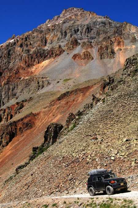
Governor Basin (Unofficial)
4.5 kmThis is not an organized trail run at the FJ Summit.
Trail time: 2-3 hours
Because this trail is not as used as Yankee Boy Basin it ends up being a lot more private. It is a network of trails with lots of sights to see. The network of trails starts right away after a climb on a shelf road. The whole area is fun to explore. As you are climbing the switchbacks keep your eyes peeled for a very well-hidden trail that leaves from the turnoff in a switchback as you climb and make a right turn. This is the place you will come back to if you make a loop around Sidney Basin. The trail at this end is narrow, off camber, and not traveled very often.
October 28, 2015
Hema Explorer - Map Patrol Grand Canyon
124.6 kmThe journey to the Grand Canyon spans the northern most point of the Arizona traverse. From the town of Williams Arizona, the track stretchy nearly 78 miles into the heart of the national park and the edge of the canyon.
The drive is easy to moderate throughout, but several spots are extremely bumpy. If it has rained recently, you will also need to be careful of the thick mud and deep pits.
The drive begins in the pines and winds its way down forest roads. The track gets smoother as time goes on and many sections are quite fast. The trees eventually give way to plains and cattle with long open views. By the time you hit national forest land the track is very light and at times is covered with fallen trees or tall grass. Stay closely to the gps track as a wrong turn can be difficult to retrace.
The trail concludes on a paved park road just opposite the canyon.
There is a fee station along this entrance but it is usually closed. Please be sure to pay the appropriate use fees upon leaving the park.
October 23, 2015
Hema Explorer - Map Patrol Central Arizona Traverse
290.5 kmThis is the central portion of the Arizona Traverse and it spans between Interstate 10 and Mayer Arizona. Total distance of the track is 180 miles making it fairly long, however fuel is available along the way in Wickenburg Arizona and Crown King Arizona. Be sure to stop in both even if you don't need fuel, the food and experience of both places is worth the time.
Starting from the south you'll wind your way through cacti and open desert with barren mountains on the horizon. The further you travel north the more vegetation you being to see. Through sandy washes and up mountains you eventually find yourself surrounded by pine trees and rolling down smooth red dirt.
The track can be moderate to very difficult depending on weather conditions and the roads condition after rain. We had to move several boulders and abandon a few tracks due to severe washouts or overgrowth. Four wheel drive is REQUIRED.
Fauna and flora are both diverse and are congruent with desert and high desert environments. Proper precautions should be taken for this trip including sat comms or a spot device, medical kits, spare tire, and recovery gear. Some places require an experienced driver and a spotter to safely navigate.
Although difficult in places, the trip is certainly rewarding and should be completed in around 3 days if proper time is taken.
September 18, 2015
Hema Explorer - Map Patrol Big Bend National Park
371.9 kmIf you're looking for a Texas sized adventure in the lone-star state this is it! Spanning over 800,000 acres, Big Bend National park holds plenty of opportunity for back road fun and exploration.The path we chose runs south from Alpine Texas to the west side of of the park and totals 231 miles.
From the entrance you transition to dirt and cruise down to the Rio Grande river, the states southern border. Beautiful cliffs line the opposite side of the bank and many rock formations are truly breath taking. The road winds its way along the shore and stops by many historical buildings and sites.
Continue along the river to visit the natural hot springs and bath I'm the rio grande. Just don't swim across to Mexico! If you are in the mood to cross borders, the town of Boquillas is just down the road. Catch a row boat across the border and bring your pass port. Cold cervesas await on the other side.
In the central and northern portions of the park, grand views of valleys, cliffs, and plateaus greet you around every bend.
This is the largest preserved section of chihuahuan desert in the United States, so be on the lookout for more than 1,200 species of plants, 450 species of birds, 56 species of reptiles, and 75 species of mammals.
Fuel stops are rare so take advantage of them when you can. Overall trail ratings are easy with a few moderate sections thrown in the mix at black gap pass.
We highly recommend using a detailed National Park Map along with this GPS track.
May 11, 2016
Created:
May 22, 2015
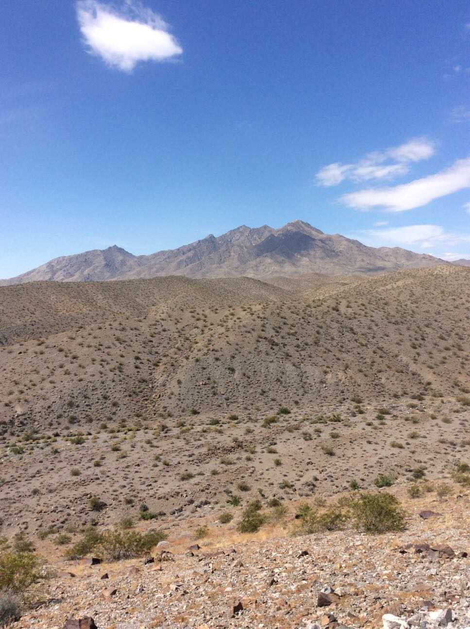
Hema Explorer - Map Patrol Mojave Road
356.2 kmThe Mojave Road traverses 140 miles of the Mojave National Preserve. Though not exceptionally technical, the remote water-less expanses, historical nature, and impressive topography have made this a classic overland track. We've added on to this scenic route to lengthen the trip and include a secluded beach camp site where travelers may escape the desert heat. The trail includes large sand washes, dry lake beds, heavy silt, steep ascents and descents, and cross-axle hills requiring low-range and careful tire placement.
Flora includes the unique Joshua Tree which appears as something out of a doctor Seuss book, yucca plants, cacti, creosote, and other plants typical of the desert southwest. Fauna ranges widely from owls, small mice, and rodent, to reptiles like gila monsters tortoise and chuckwalla, up to larger predators like cougars.
If you plan to traverse the route, we highly recommend coupling this GPS track with the Mojave Road Guide by Dennis Casebier. It gives an excellent overview of the trails history and provides interesting information along the way.
The track can be completed without refueling if you plan accordingly, however the town of Baker can be the perfect spot to hop off the trail, fill the tanks, and grab a cold drink to escape the heat. There is little to no support along the trail so be sure to bring food, water, a spare tire, and appropriate medical supplies for safety. A spot device or sat phone is recommended.