March 02, 2018
October 16, 2018
Created:
November 01, 2015
Hema - Kutini-Payamu (Iron Range) National Park
178.0 kmFOR MORE INFORMATION ON THIS TRACK, PLEASE REFER TO OUR CAPE YORK ATLAS & GUIDE: http://bit.ly/capeguide
GRADING: As far as tracks throughout Cape York go, the trip to Kutini-Payamu is straightforward, only requiring AWD more often than not.
THE DRIVE: The drive isn't a difficult one, other than some creek crossings that can be rocky. It's worth taking a walk around the Batavia Gold Mine ruins, and spending some time camping at Rainforest, Gordon Creek, Cooks Hut and Chili Beach.
320526322a26087ea2ed68e0ca851e31scaled.jpg
October 16, 2018
Created:
June 02, 2014
Hema - Bamaga to Pajinka (The Tip)
66.5 kmHEMA CAPE YORK ATLAS & GUIDE - TRACK #15
This trip from Bamaga to The Tip (the northernmost point on the Australian mainland) requires low range and high ground clearance, with the most difficult section coming on the return drive towards Punsand Bay, which can become impassable when wet.
This is Track #15 in Hema's Cape York Atlas & Guide, which you can purchase online here: http://bit.ly/capeguide

My Photo - 3/06/2014 9:01:04am
October 16, 2018
Created:
November 02, 2015
Hema - Frenchmans Track
75.9 kmFOR MORE INFORMATION ON THIS TRACK, PLEASE REFER TO OUR CAPE YORK ATLAS & GUIDE: http://bit.ly/capeguide
GRADING: This track requires low range, high ground clearance, traction aids and recovery gear.
THE DRIVE: Ideal as either a day trip or overnighter, Frenchmans Track is a challenging and scenic track that is rife with stony and slippery surfaces, steep grades and deep river crossings. It is worth combining this trip with a drive out to Kutini Payamu National Park.
1f43e7858d789095de1a9bc51de7050fscaled.jpg
October 16, 2018
Created:
October 25, 2015
Hema - CREB Track (Daintree to Cooktown)
135.2 kmFOR MORE INFORMATION ON THIS TRACK, PLEASE REFER TO OUR CAPE YORK ATLAS & GUIDE: http://bit.ly/capeguide
GRADING: This track requires low range, high ground clearance, traction aids and recovery gear. The CREB Track shouldn't be attempted after rain due to the red clay that makes up most of its length.
THE DRIVE: 60km through deep rainforest along steep tracks make the CREB one of the best and most challenging 4WD tracks in North Queensland. Linking Daintree and Cooktown, it's a baptism of fire for many travellers seeking the Tip of Cape York. The first 15km are easy, winding through rainforest with great views and waterfalls along the way. Once you get into the McDowall Range though, the CREB Track shows its true colours.
cbb78d1c32858049513e24c098c04c1dscaled.jpg
October 16, 2018
Created:
November 04, 2015
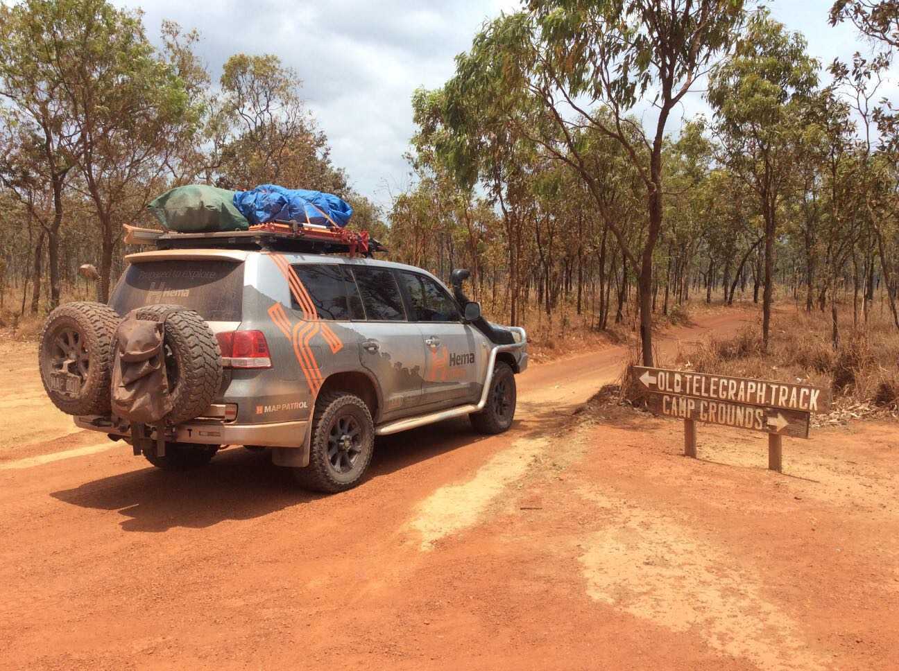
Hema - Old Telegraph Track South
94.2 kmFOR MORE INFORMATION ON THIS TRACK, PLEASE REFER TO OUR CAPE YORK ATLAS & GUIDE: http://bit.ly/capeguide
GRADING: This track requires low range, high ground clearance, traction aids and recovery gear, and contains deep creek crossings and slippery, steep river banks.
THE DRIVE: The southern section of the Old Telegraph Track can take one to two days, depending on your personal preference and the OTT's seasonal track conditions. The first major obstacle is Palm Creek, followed by Ducie Creek, Dulhunty River, Bertie Creek, Gunshot, Cockatoo Creek and Sailor Creek - leaving little wonder as to why it's one of Australia's most famed tracks. Palm Creek and Gunshot are the most challenging crossings, while the Dulhunty offers plenty of swimming opportunities before ending the track at Fruit Bat Falls.