January 14, 2016
January 06, 2015
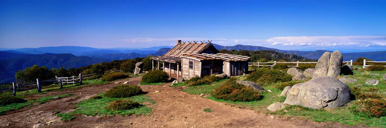
Sandy Flat to Powers Lookout via McDonalds Gap Track loop
111.1 km4WD tracks: Sandy Flat Trk, Long Spur Trk, (King River Rd, Christophers Rd), MacDonald Trk, (Mansfield-Whitfield Rd, King Valley Rd, Rose River Rd, Paradise Falls Rd), Wobonga Trk, Stockyard Trk, Long Spur Trk, Sandy Flat Trk.
This was mainly a sightseeing tour to Powers lookout (which provided a spectacular view of the King Valley) with part tracks and part bitumen and Christophers Rd which was a fairly flat dirt road was pretty benign but deteriorated a bit the further we went along. We passed through a couple of gates and the track turned sharply to the right onto MacDonald Trk and upwards steeply where a sign said dry weather track only. This track continued to climb sharply for a couple of kilometres with switchbacks and ruts and met the bitumen of the Mansfield-Whitfield Rd abruptly. It is a great climb up McDonald's Spur.
We incorporated a winery visit but you could visit many more along the King Valley Rd and stopped in at Paradise Falls which were dry for our visit in January.

IMG_9754.JPG
January 05, 2015
Sandy Flat to Mt Buller loop via Cambatong Spur Track
103.7 kmEvans Creek track was straightforward. The climb up Cambalong Spur track was challenging and the views from the junction near Bald Hill were spectacular as were those from the top of Mt Buller. The return trip was more direct and easy dirt road driving apart from Buckland Spur track and the descent at the end. .
Sandy Flat is a great camp site for up to about 10 camper trailers with several separated areas and right next to the King River.

IMG_9624.JPG
January 04, 2015
Sandy Flat to Lake Cobbler via the Staircase
92.1 kmInteresting climb out of camp straight up Sandy Flat track and saddle to cross near Burnt Top Hill. Visit Pineapple Flat and along King River to Kings Hut campsite before the climb up the staircase towards Lake Cobbler. Return trip back to camp is straightforward until the last descent again on Sandy Flat track.
January 01, 2015
Sandy Flat to Tomahawk Hut along Buckland Spur
40.3 kmStraight from Sandy Flat we started by crossing the King River and headed back to the north western corner of the Alpine Park where we turned up Buckland Spur Trk which was a very long and steep climb to the ridge top. It was a dusty drive along the ridge but with some spectacular views of the valley at times.
After about 90 minutes we reached Tomahawk Hut and had a look around. We returned back up the track until we reached the ‘T’ junction we had passed by earlier and turned down Evans Creek Trk. It started with a steep descent and switch backs before crossing a creek and flattening out to an easy drive until we reached Evans Creek Hut. We continued down Evans Creek Trk. It was easy driving with few climbs and we arrived back at camp after completing a loop.

IMG_0904.JPG
March 29, 2017
Created:
March 06, 2017