


July 15, 2014
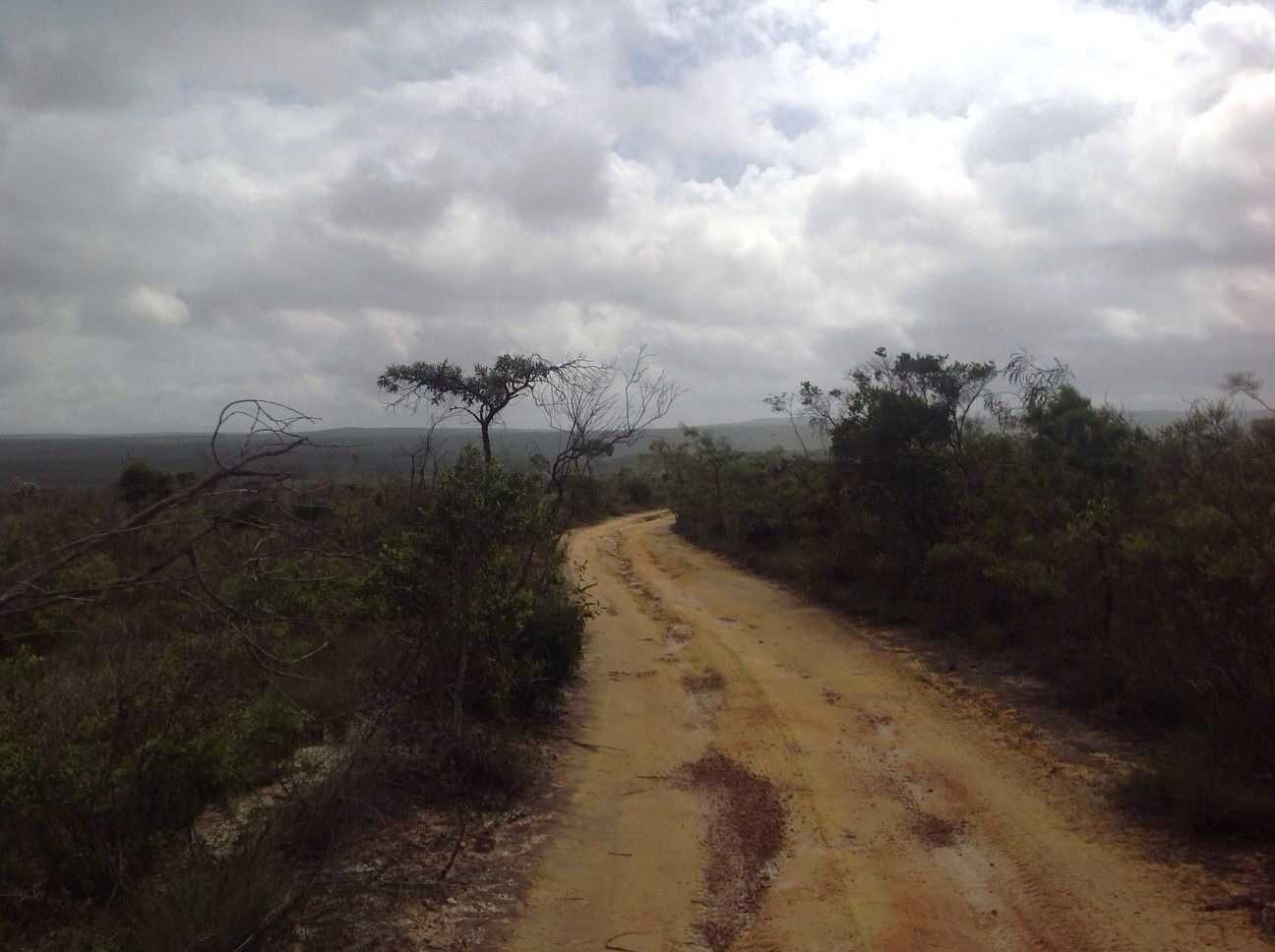
Hema - Hay River Track to Poeppel Corner
20.1 kmHEMA SIMPSON DESERT - K1 LINE
This track runs along the Hay River Track to reach Poeppel Corner, which is the convergence of the Queensland, South Australia and Northern Territory borders.
The point is named after Augustus Poeppel, who conducted a survey in the 1880s to exactly mark out the borders of the three central states with a coolibah post he had dragged there by camel. The post has since moved to more accurately reflect the intersection and was even replaced in 1989, while an official marker has been laid to definitively mark today's state borders nearby.
For more information on Australia's arid centre, get a copy of our Great Desert Tracks Atlas & Guide online: http://bit.ly/gdtguide
July 15, 2014
Hema - French Line
257.9 kmHEMA SIMPSON DESERT - POEPPEL CORNER TO DALHOUSIE
This track covers the French Line and the Spring Creek Track through to Dalhousie Springs. The dunes become softer on the western end of the French Line, making travel slow and steady, with the French Line itself ending at Purni Bore in Witjira National Park.
The Spring Creek Track then leads to Dalhousie and Dalhousie Springs, which is home to over 60 artesian hot water springs. The highly mineralised water is a perfect tonic for weary travellers, and though its total flow rate is only two-thirds of what it was 100 years ago, Dalhousie Springs is still a bountiful desert oasis that's well worth the journey.
For more information on Australia's arid centre, get a copy of our Great Desert Tracks Atlas & Guide online: http://bit.ly/gdtguide
July 13, 2014
Hema - QAA Line
149.2 kmHEMA SIMPSON DESERT - BIRDSVILLE TO K1 LINE
The QAA Line runs from Big Red (Nappanerica), the highest dune in the Simpson Desert, to the junction with the K1 Line just across the Northern Territory border. The amount of traffic this track sees means that it is generally one of the most challenging tracks through the Simpson Desert due to churned sand around the dunes.
For more information on Australia's arid centre, get a copy of our Great Desert Tracks Atlas & Guide online: http://bit.ly/gdtguide
July 12, 2014
Hema - Charleville to Birdsville
845.7 kmHEMA SIMPSON DESERT - CHARLEVILLE TO BIRDSVILLE
This track runs from Charleville in Outback Queensland to Birdsville, following the Diamantina Developmental Road and Birdsville Developmental Road to reach the edge of the Simpson Desert.
For more information on Australia's arid centre, get a copy of our Great Desert Tracks Atlas & Guide online: http://bit.ly/gdtguide
June 07, 2014
Hema - Musgrave Roadhouse to Marina Plains [Rinyirru (Lakefield) National Park]
109.6 kmHEMA CAPE YORK - MUSGRAVE ROADHOUSE TO RINYIRRU
Driving from Musgrave Roadhouse into Rinyirru (Lakefield) National Park before a water-induced road closure stopped our progress. This track links up with Rinyirru (Lakefield) National Park Part 1, which runs from Laura to Kalpowar.
Rinyirru (Lakefield) National Park is an explorer's paradise, with barramundi fishing aplenty and many tracks and attractions to visit throughout.
This is Track #5 (in part) in Hema's Cape York Atlas & Guide, which you can purchase online here: http://bit.ly/capeguide
June 06, 2014
Hema - Chili Beach to Archer River Roadhouse [Kutini-Payamu (Iron Range) National Park]
188.6 kmHEMA CAPE YORK ATLAS & GUIDE - TRACK #8
The overnight return trip from Archer River Roadhouse to Cape Weymouth is not a challenge when dry, but the drive into Kutini-Payamu (Iron Range) National Park can become difficult after rain. This return trip was from Portland Roads to Cape Weymouth and Chili Beach, down to Lockhart River and back along Portland Roads before meeting again with the Peninsula Developmental Road.
Kutini-Payamu is home to the largest remaining area of lowland rainforest in Australia, making the drive into the park a scenic one.
This is Track #8 in Hema's Cape York Atlas & Guide, which you can purchase online here: http://bit.ly/capeguide
June 05, 2014
Hema - Portland Roads [Kutini-Payamu (Iron Range) National Park]
147.6 kmHEMA CAPE YORK ATLAS & GUIDE - TRACK #8
This overnight trip is not a challenge when dry, but the drive into Kutini-Payamu (Iron Range) National Park can become difficult after rain. It's a popular choice to deviate before reaching Portland Roads to head to Cape Weymouth and Chili Beach, while on the return route the offshoot that meets with Frenchmans Track is an adventurous alternative to come back.
Kutini-Payamu is home to the largest remaining area of lowland rainforest in Australia, making the drive into the park a scenic one.
This is Track #8 in Hema's Cape York Atlas & Guide, which you can purchase online here: http://bit.ly/capeguide
My Photo - 5/06/2014 1:32:17pm
June 03, 2014
Hema - Bamaga to Somerset (East Coast of The Tip)
32.5 kmHEMA CAPE YORK ATLAS & GUIDE - TRACK #14
Heading from Bamaga to the old Somerset Ruins and Nanthau Beach, which requires low range gearing and high ground clearance to negotiate.Facilities are sparse as they can only be found in Bamaga and Seisia.
This is Track #14 in Hema's Cape York Atlas & Guide, which you can purchase online here: http://bit.ly/capeguide
June 03, 2014
Hema - Bamaga to Pajinka (The Tip)
66.5 kmHEMA CAPE YORK ATLAS & GUIDE - TRACK #15
This trip from Bamaga to The Tip (the northernmost point on the Australian mainland) requires low range and high ground clearance, with the most difficult section coming on the return drive towards Punsand Bay, which can become impassable when wet.
This is Track #15 in Hema's Cape York Atlas & Guide, which you can purchase online here: http://bit.ly/capeguide
There are no favorites to display