

November 01, 2015
Hema - Kutini-Payamu (Iron Range) National Park
178.0 kmFOR MORE INFORMATION ON THIS TRACK, PLEASE REFER TO OUR CAPE YORK ATLAS & GUIDE: http://bit.ly/capeguide
GRADING: As far as tracks throughout Cape York go, the trip to Kutini-Payamu is straightforward, only requiring AWD more often than not.
THE DRIVE: The drive isn't a difficult one, other than some creek crossings that can be rocky. It's worth taking a walk around the Batavia Gold Mine ruins, and spending some time camping at Rainforest, Gordon Creek, Cooks Hut and Chili Beach.
320526322a26087ea2ed68e0ca851e31scaled.jpg
October 30, 2015
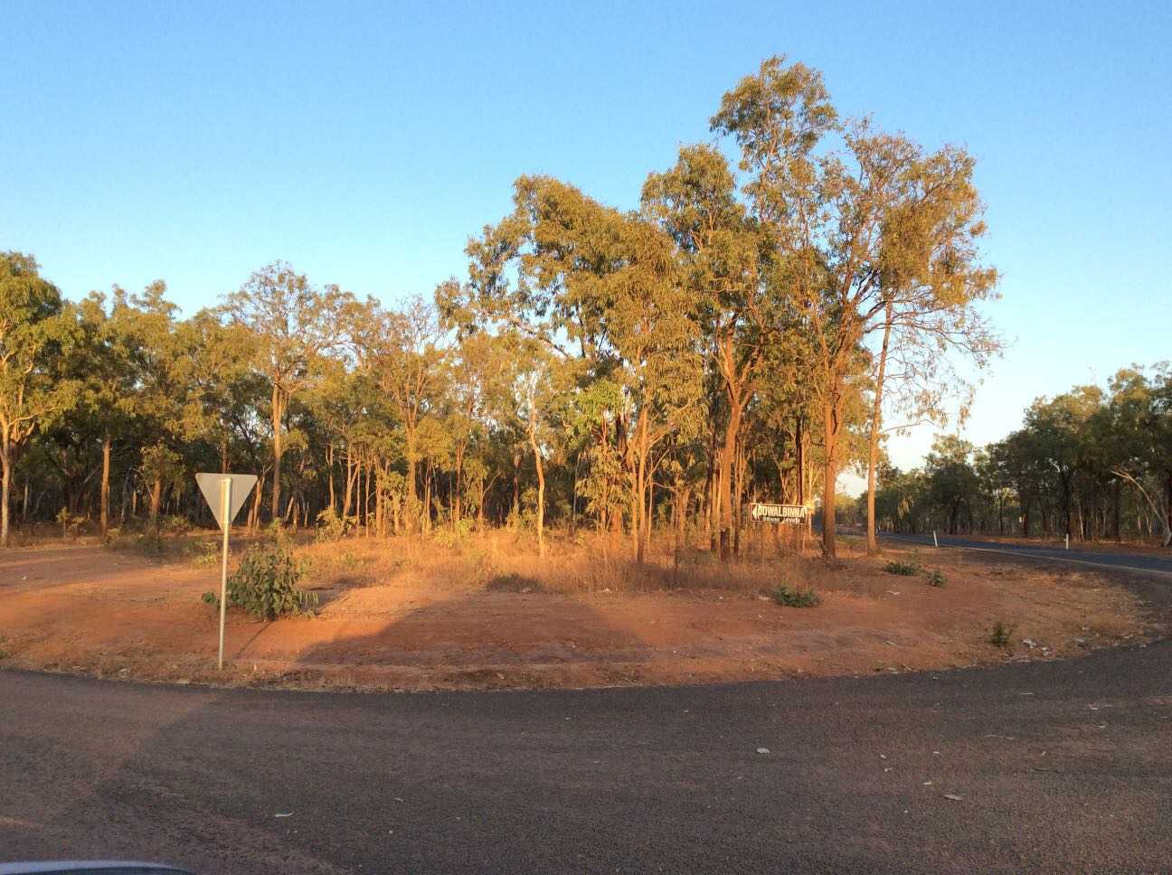
Hema - Palmer River Goldfields
156.8 kmFOR MORE INFORMATION ON THIS TRACK, PLEASE REFER TO OUR CAPE YORK ATLAS & GUIDE: http://bit.ly/capeguide
GRADING: This track requires low range and high ground clearance, with steep-banked dry creek crossings.
THE DRIVE: The track begins on the Peninsula Development Road (PDR) just north of Laura, with a large sign for Jowalbinna marking the turn. The track heads through open woodlands, which are broken by sandstone escarpments carved by water and wind. There are plenty of steep grades, rough surfaces and rock steps on offer throughout, which makes this one of Cape York's most epic and more traditional tracks.
3e0c477c05b9abb635561a824e7f11d6scaled.jpg
October 27, 2015
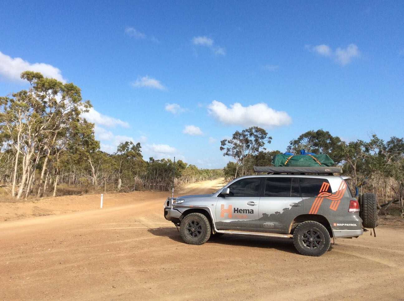
Hema - Cape Melville National Park
271.1 kmFOR MORE INFORMATION ON THIS TRACK, PLEASE REFER TO OUR CAPE YORK ATLAS & GUIDE: http://bit.ly/capeguide
GRADING: This track requires low range, high ground clearance, traction aids and recovery gear. Be warned: this is a remote area with no supplies or reliable water sources.
THE DRIVE: This trip will take at least 4 days, with 233km from Cooktown to Cape Melville, or 376km from Cooktown to Bathurst Head. The run from Cooktown to Battle Camp Road is mainly bitumen and in good condition, with the track dropping into deep rainforest before opening up to a wide graded track until after Starcke Station. After that, it becomes a true 4WD track, with washouts, bulldust, potholes and stone shelves, making it a hard slog to reach Cape Melville.
e47398e5038793a6c8efee7e359fa8f0scaled.jpg
October 26, 2015
Hema - Starcke Coast
249.4 kmFOR MORE INFORMATION ON THIS TRACK, PLEASE REFER TO OUR CAPE YORK ATLAS & GUIDE: http://bit.ly/capeguide
GRADING: This track requires low range and high ground clearance, as well as traction aids in some areas.
THE DRIVE: This trip can take 2-4 days, leaving Cooktown and heading north around the Endeavour River. The track takes you to attractions such as Elim Beach and the Coloured Sands, Cape Bedford and Cape Flattery.
In 1886, a Lutheran Church set up a misson on Elim Beach, and after being evacuated during WWII, it was reestablished in 1949. The Starcke River Goldfield enjoyed a brief rush from around 1890, but nothing remains of the small township from which 4000 ounces of gold were found all those years ago.
89748eb7267663b8a1477dccca66c1d4scaled.jpg
October 25, 2015
Hema - CREB Track (Daintree to Cooktown)
135.2 kmFOR MORE INFORMATION ON THIS TRACK, PLEASE REFER TO OUR CAPE YORK ATLAS & GUIDE: http://bit.ly/capeguide
GRADING: This track requires low range, high ground clearance, traction aids and recovery gear. The CREB Track shouldn't be attempted after rain due to the red clay that makes up most of its length.
THE DRIVE: 60km through deep rainforest along steep tracks make the CREB one of the best and most challenging 4WD tracks in North Queensland. Linking Daintree and Cooktown, it's a baptism of fire for many travellers seeking the Tip of Cape York. The first 15km are easy, winding through rainforest with great views and waterfalls along the way. Once you get into the McDowall Range though, the CREB Track shows its true colours.
cbb78d1c32858049513e24c098c04c1dscaled.jpg
September 09, 2015
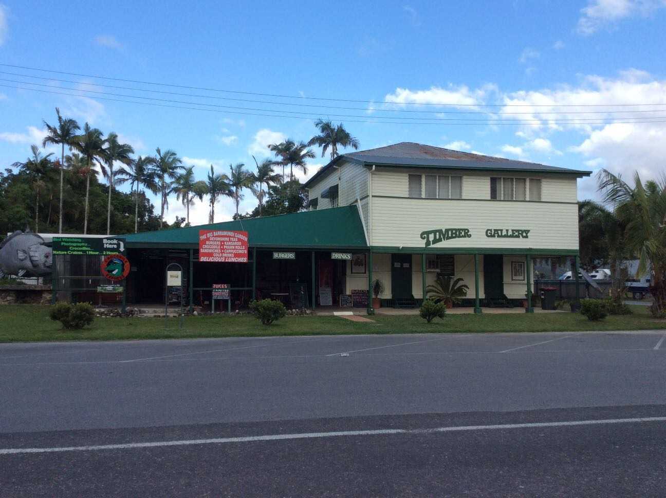
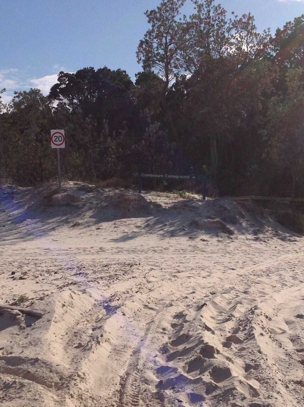
Hema - Moreton Island: Bulwer to Cape Moreton
19.6 kmWe captured this track while on Moreton Island for a staff training week as we headed from Bulwer to Cape Moreton. Changes in the positioning of the beach over time shows our track in the water at certain points in the track, which will be updated as a result of this expedition.
The drive up the western beach is a simple task when timed with the tides, while the softest sand is often found at the beach access points. All the campgrounds on Moreton Island are well shaded and close to the beach, and the official camping areas are grassy and open.
Moreton Island is the third-largest sand island in the world below Fraser Island and North Stradbroke, and it is the quietest of the three. The island is home to sandy 4WD tracks, numerous scenic spots, and a wide range of environs that make it a truly unique place to visit.
a112efe95b4ddac2a47f7cbecd1dd669scaled.jpg
July 15, 2014
Hema - French Line
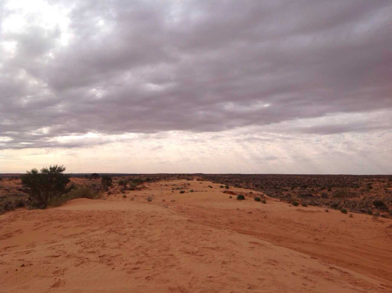
257.9 kmHEMA SIMPSON DESERT - POEPPEL CORNER TO DALHOUSIE
This track covers the French Line and the Spring Creek Track through to Dalhousie Springs. The dunes become softer on the western end of the French Line, making travel slow and steady, with the French Line itself ending at Purni Bore in Witjira National Park.
The Spring Creek Track then leads to Dalhousie and Dalhousie Springs, which is home to over 60 artesian hot water springs. The highly mineralised water is a perfect tonic for weary travellers, and though its total flow rate is only two-thirds of what it was 100 years ago, Dalhousie Springs is still a bountiful desert oasis that's well worth the journey.
For more information on Australia's arid centre, get a copy of our Great Desert Tracks Atlas & Guide online: http://bit.ly/gdtguide
My Photo - 15/07/2014 2:54:50pm
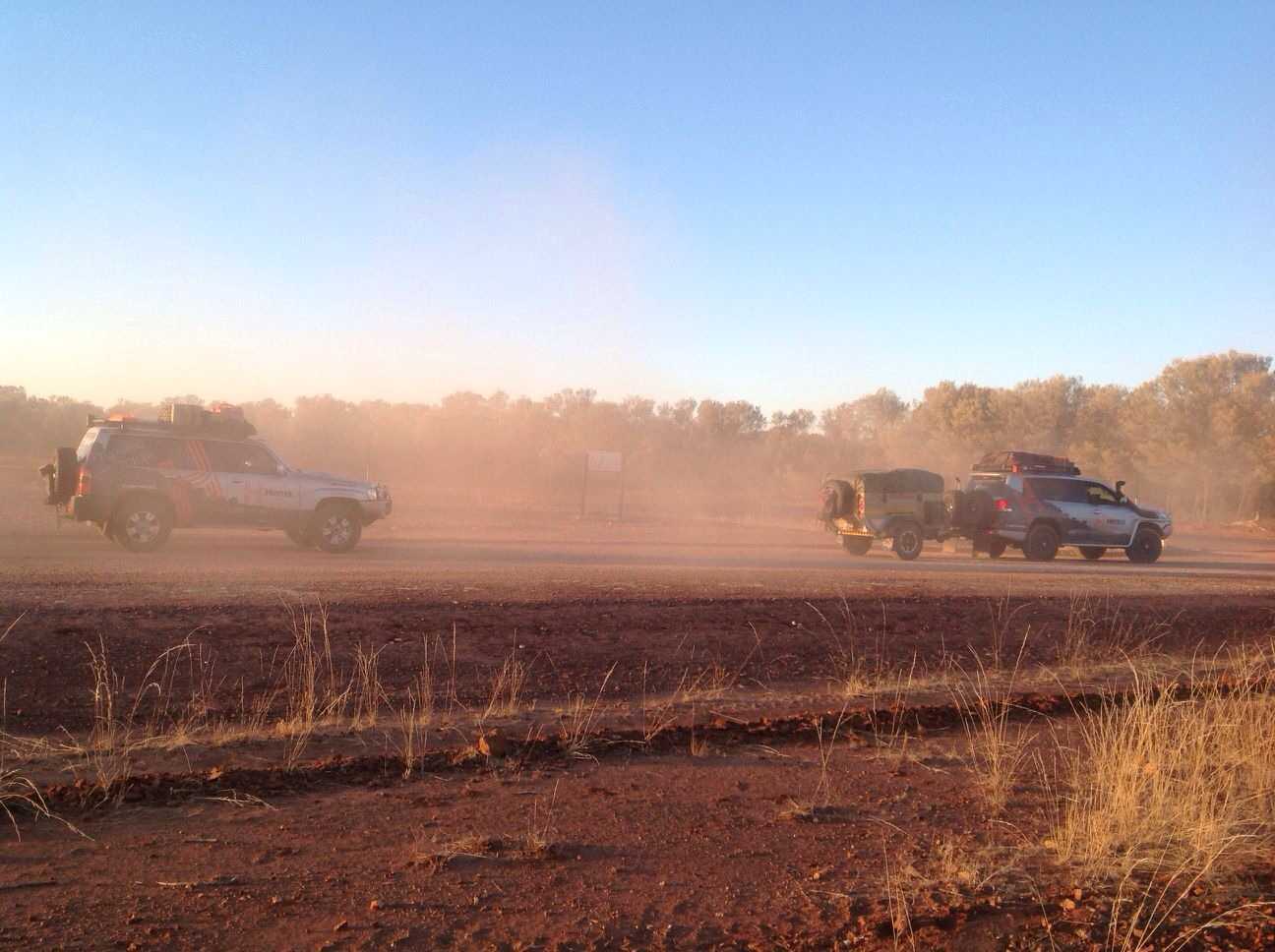
July 15, 2014
Hema - Hay River Track to Poeppel Corner
20.1 kmHEMA SIMPSON DESERT - K1 LINE
This track runs along the Hay River Track to reach Poeppel Corner, which is the convergence of the Queensland, South Australia and Northern Territory borders.
The point is named after Augustus Poeppel, who conducted a survey in the 1880s to exactly mark out the borders of the three central states with a coolibah post he had dragged there by camel. The post has since moved to more accurately reflect the intersection and was even replaced in 1989, while an official marker has been laid to definitively mark today's state borders nearby.
For more information on Australia's arid centre, get a copy of our Great Desert Tracks Atlas & Guide online: http://bit.ly/gdtguide
My Photo - 15/07/2014 11:11:35am
July 13, 2014
Hema - QAA Line
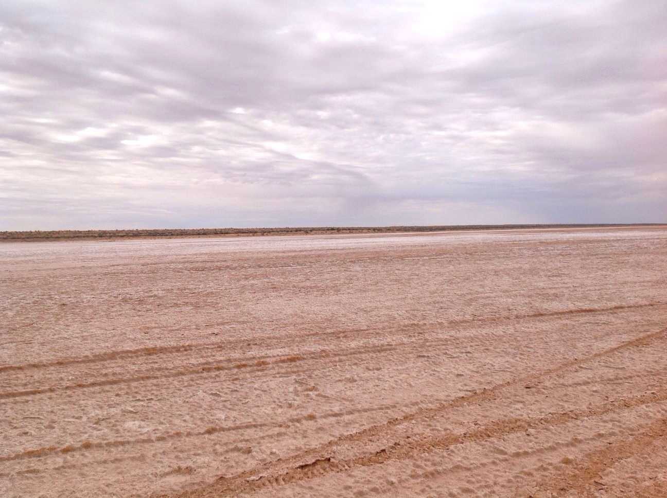
149.2 kmHEMA SIMPSON DESERT - BIRDSVILLE TO K1 LINE
The QAA Line runs from Big Red (Nappanerica), the highest dune in the Simpson Desert, to the junction with the K1 Line just across the Northern Territory border. The amount of traffic this track sees means that it is generally one of the most challenging tracks through the Simpson Desert due to churned sand around the dunes.
For more information on Australia's arid centre, get a copy of our Great Desert Tracks Atlas & Guide online: http://bit.ly/gdtguide
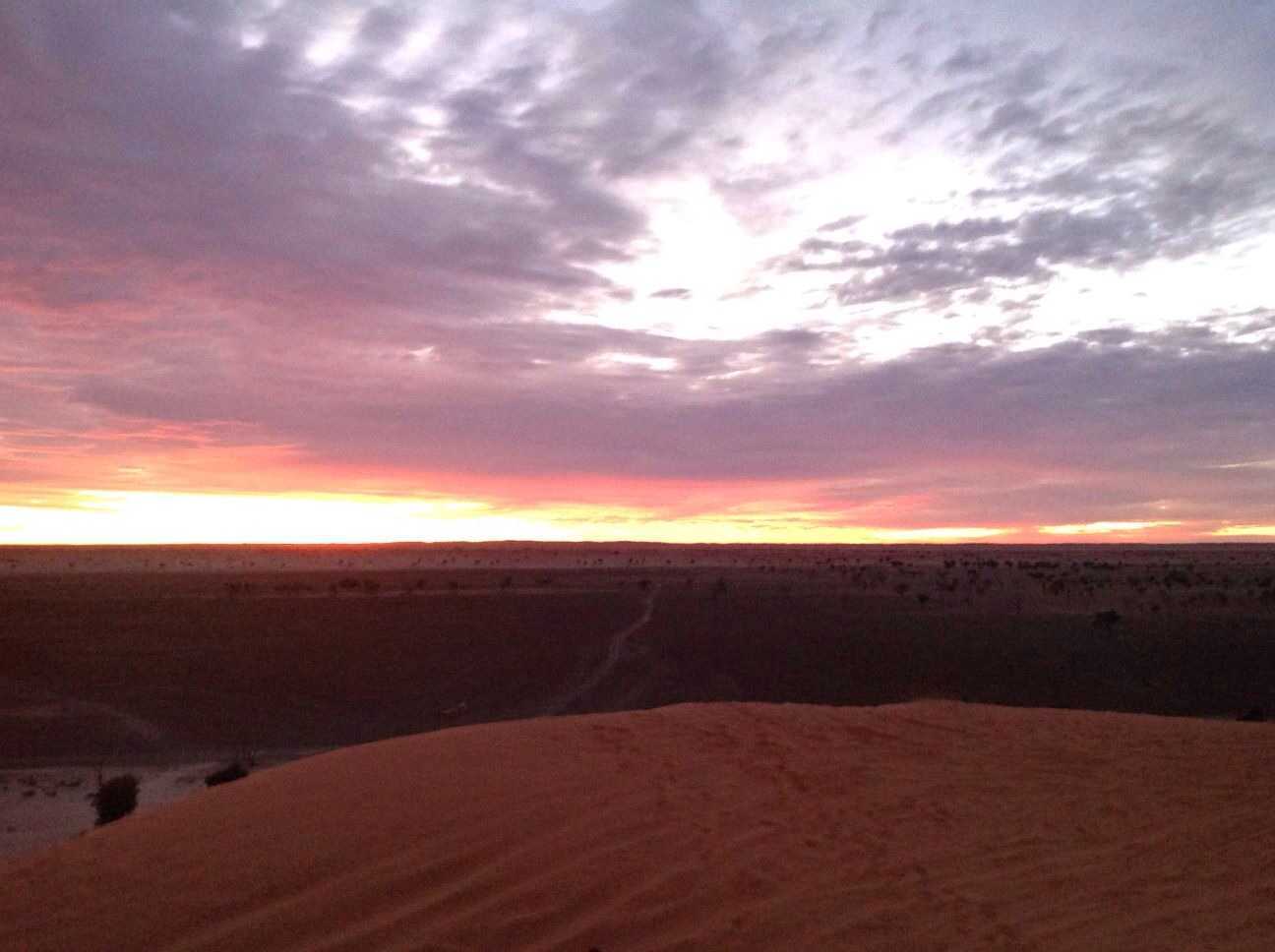
My Photo - 13/07/2014 7:10:54am
July 11, 2014
Hema - Charleville to Birdsville
845.7 kmHEMA SIMPSON DESERT - CHARLEVILLE TO BIRDSVILLE
This track runs from Charleville in Outback Queensland to Birdsville, following the Diamantina Developmental Road and Birdsville Developmental Road to reach the edge of the Simpson Desert.
For more information on Australia's arid centre, get a copy of our Great Desert Tracks Atlas & Guide online: http://bit.ly/gdtguide
My Photo - 12/07/2014 7:32:22am
There are no favorites to display