

May 05, 2016
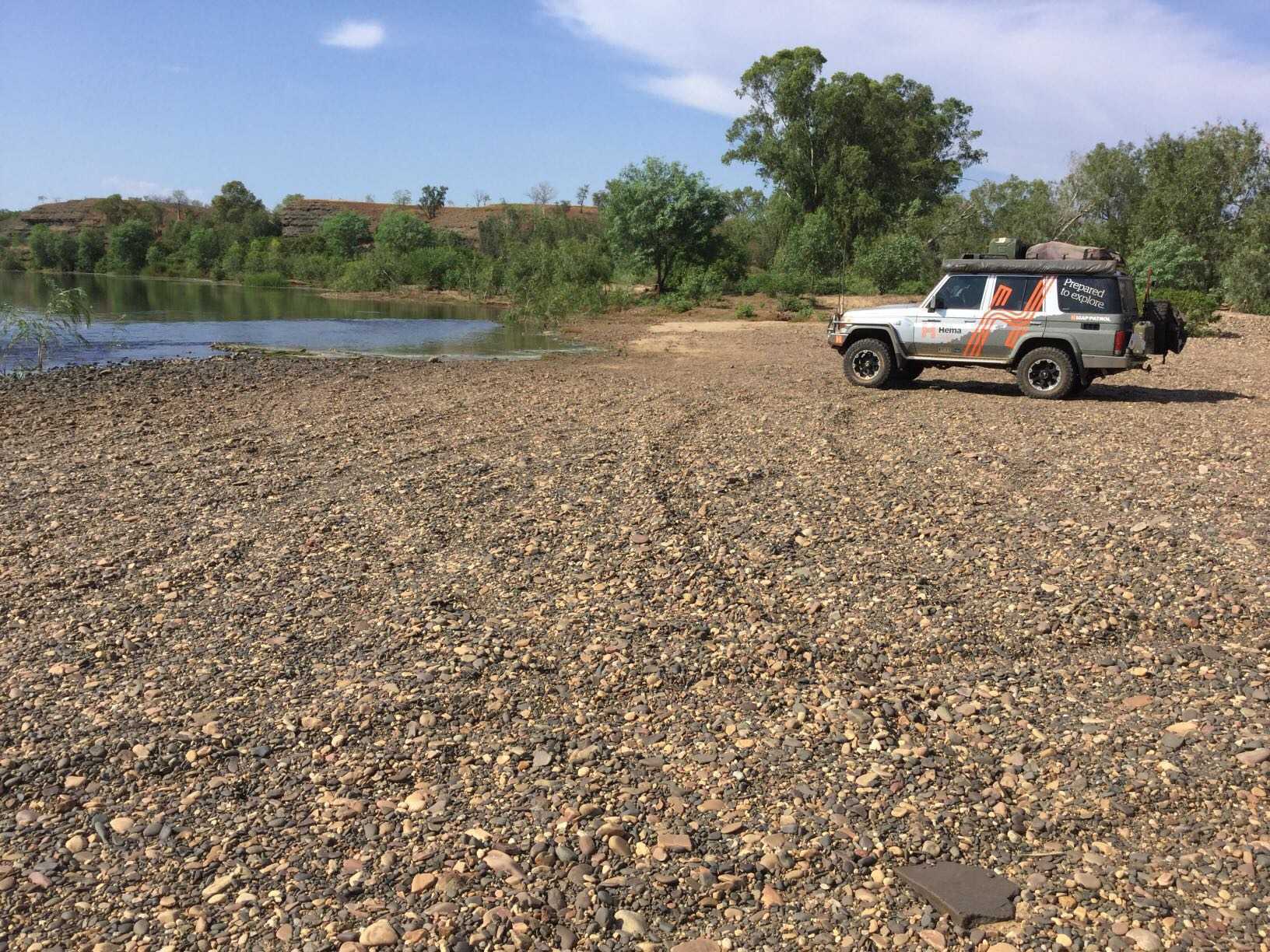
Hema - Parry Creek
126.5 kmHema Kimberley Atlas & Guide - Track #5
This drive features billabongs, rivers, spectacular birdwatching and a touch of gold-rush history. Starting in Kununurra, the track comes in contact with with the Ord River, Valentine Springs, Middle Springs, Black Rock Falls, Parry Creek Farm, Parry Lagoon and Marlglu Billabong.
This is track #5 in Hema's Kimberley Atlas & Guide, which features atlas mapping and guidance to the Kimberley's Top 10 4WD Trips.
bc70af89b7a12a9bb9a7f5ac94dd1962scaled.jpg
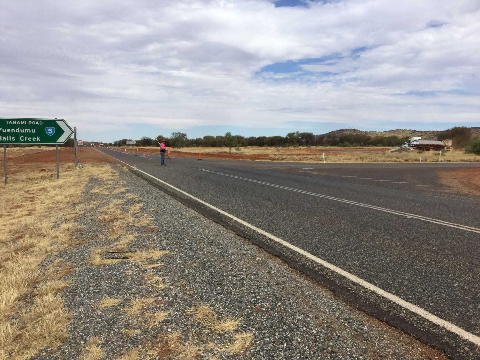
May 03, 2016
Hema - Tanami Track
1062 kmHema Kimberley Atlas & Guide - Track #4
The Tanami is one of Australia's easier outback tracks, with frequent grading occurring on the Northern Territory side of the track for the mining vehicles that traverse it. From Alice Springs to Halls Creek, the track comes in contact with the northern end of the Canning Stock Route and Wolfe Creek Crater, while there's a bush camping spot at Renahans Bore.
This is track #4 in Hema's Kimberley Atlas & Guide, which features atlas mapping and guidance to the Kimberley's Top 10 4WD Trips.
33c1726233d8f95617e9c959860e719fscaled.jpg
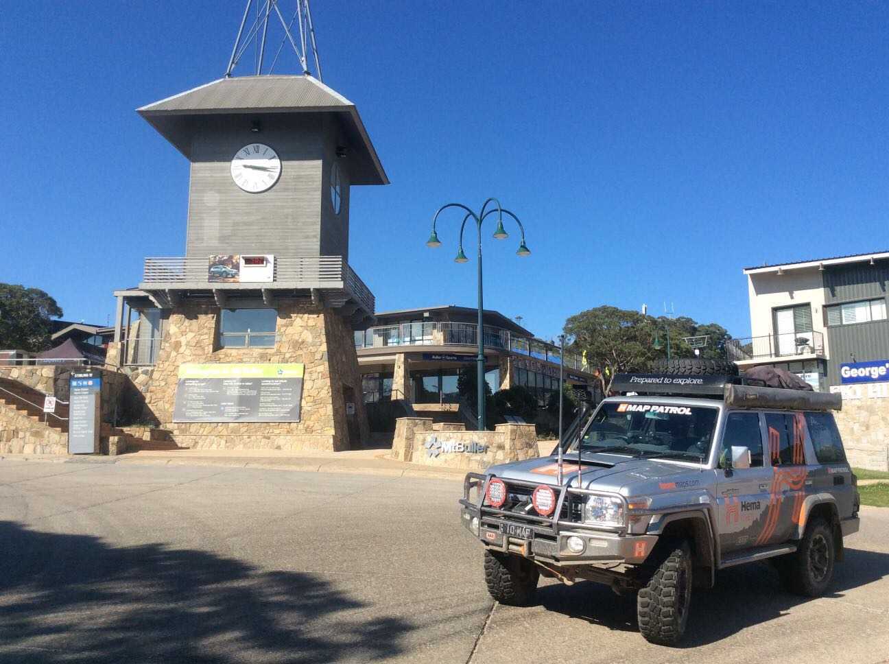
January 14, 2016
Hema - Mt Buller to Sawmill Settlement
70.6 kmFOR MORE INFORMATION ON THIS TRACK, PLEASE REFER TO OUR HIGH COUNTRY VICTORIA ATLAS & GUIDE: http://bit.ly/hemahighcountry
GRADING: This track requires low range and high ground clearance.
THE DRIVE: This trek contains some of the best views on offer throughout the High Country, starting with Mount Buller Alpine Village and looking out over Howqua Valley. Along the way you will find Craigs Hut, Pineapple Flat Camping Area, Mount Stirling and more.
b5bb1c3784d25f8da20f9d444448e849scaled.jpg
November 13, 2015
Hema - North of Weipa
159.3 kmFOR MORE INFORMATION ON THIS TRACK, PLEASE REFER TO OUR CAPE YORK ATLAS & GUIDE: http://bit.ly/capeguide
GRADING: This track requires low range and high ground clearance for the beach section of the track.
THE DRIVE: The track heads out north of Weipa, which is paved or well-graded. After 45km is a turnoff to the Pennefather River mouth, and once you get close to the coast there are tracks that run behind the dunes. Be careful driving on the beach as they are soft and uneven, and you can drive as far north as the river mouth and upstream further - beware of mangrove and bogging however.
2a5f3e00ce42f81f7132c8da7c2135a9scaled.jpg
November 09, 2015
Hema - Oyala Thumotang National Park (modified)
117.6 kmFOR MORE INFORMATION ON THIS TRACK, PLEASE REFER TO OUR CAPE YORK ATLAS & GUIDE: http://bit.ly/capeguide
GRADING: This track requires low range and high ground clearance.
THE DRIVE: Taking a minimum of 4 days, the turnoff to Oyala Thumotang National Park (formerly Mungkan Kandju National Park) is 25km north of Coen on the Peninsula Development Road. Most of the drive is on flattish tracks that run through open woodland with abundant termite mounds along the roadside; though it is interspersed with pockets of rainforest and runs alongside lily-topped lagoons in places.
1d3d09d0f4a245b2f4cf14aa28b0d932scaled.jpg
November 08, 2015
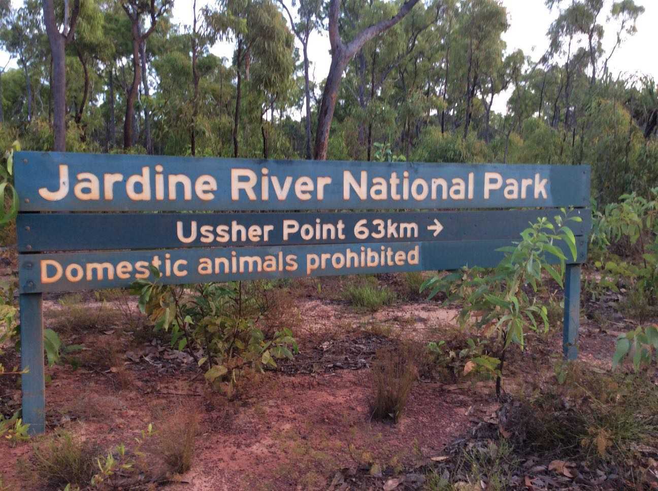
Hema - Jardine River to Ussher Point
60.8 kmFOR MORE INFORMATION ON THIS TRACK, PLEASE REFER TO OUR CAPE YORK ATLAS & GUIDE: http://bit.ly/capeguide
GRADING: This track requires low range and high ground clearance.
THE DRIVE: This trip usually takes two days or more, running from the Jardine River Ferry to Ussher Point. The track is often tight, with overhanging rainforest pressing in on you as you make your way out to the coast. There are numerous wrecks which line the coast, which makes it good for beachcombing. There's also great fishing opportunities for anyone with a rod, with a lack of fishing pressure making a good catch never too far away.
f7b262f102fdee9f781d61ed29b4feb5scaled.jpg
November 07, 2015
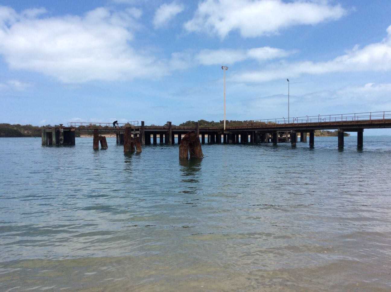
Hema - The Tip of Cape York (East Coast)
46.9 kmFOR MORE INFORMATION ON THIS TRACK, PLEASE REFER TO OUR CAPE YORK ATLAS & GUIDE: http://bit.ly/capeguide
GRADING: This track requires low range and high ground clearance.
THE DRIVE: This trip usually takes two days, running from Seisa to the Tip's east coast. Stop in at the Croc Tent on the way to the Somerset ruins before heading to Nanthau Beach via Fly Point and Vallack Point.
Somerset was one of the earliest settlements on the Cape, established in 1864. John Jardine was placed in charge of the settlement, and after an epic 10-month cattle drive from Rockhampton to Somerset, his son Frank Jardine would continue the family connection to this settlement until 1873.
d528491fd58845dbdd6bc73164f5208cscaled.jpg
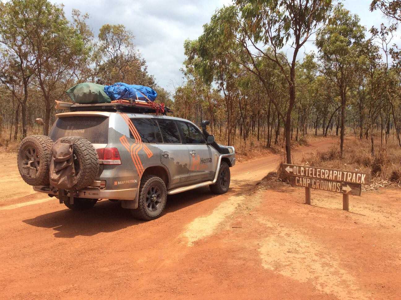
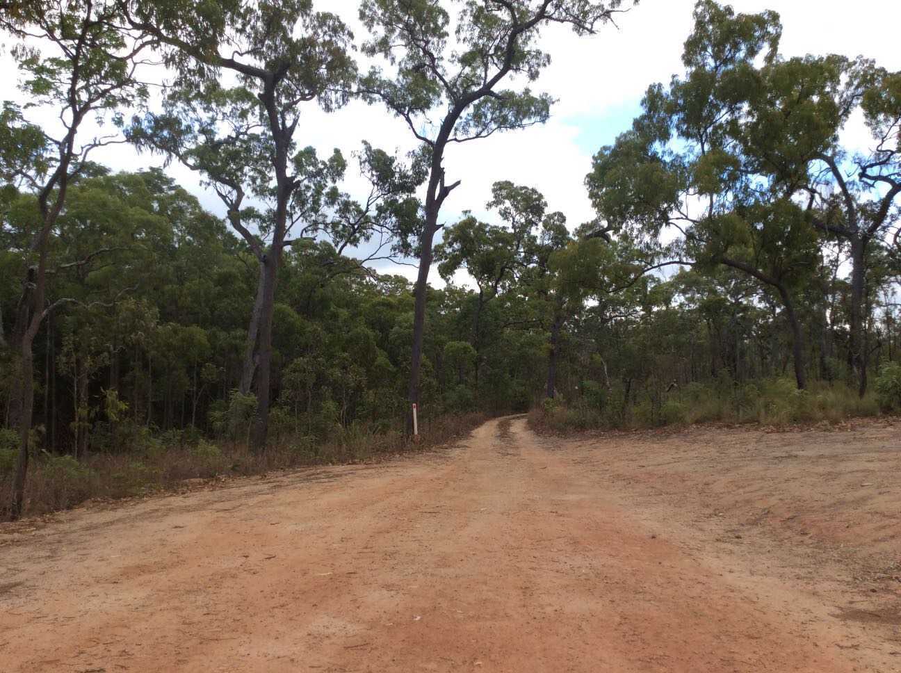
November 05, 2015
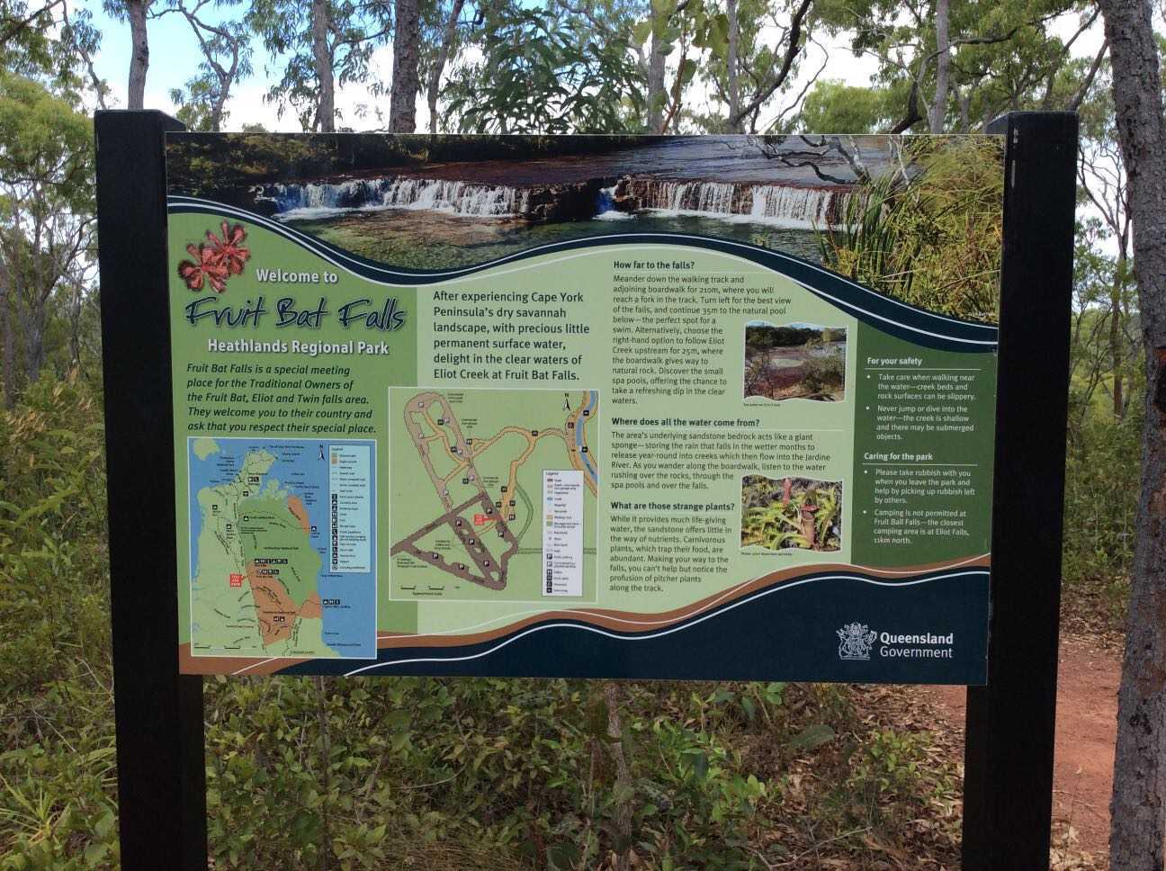
Hema - Old Telegraph Track North
86.4 kmFOR MORE INFORMATION ON THIS TRACK, PLEASE REFER TO OUR CAPE YORK ATLAS & GUIDE: http://bit.ly/capeguide
GRADING: This track requires low range, high ground clearance, traction aids and recovery gear.
THE DRIVE: The northern section of Cape York's Old Telegraph Track runs from Bamaga Road to the Jardine River Ferry. Fruit Bat Falls is a must-visit detour to the right at the beginning of the track. After this point, the track runs straight until the turnoff for Eliot, Twin and Indian Head Falls, after which comes Canal Creek. This section of the track is one of the best parts of Cape York, with the waterfalls making an ideal photographic and swim spot, and Canal Creek offers a clear, deep blue crossing that winds to the left to avoid the washed out gullies of the old exit to the right. After Canal is Sam Creek, then the more difficult Mistake Creek, followed by the reasonably simple Cannibal Creek crossing. From here is a long drive to the biggest obstacle south of the Jardine: Nolan's Brook. After Nolan's, the track continues north to the old Jardine River ford, or the turnoff to the Bamaga Rd to catch the Jardine Ferry.
f340420ac3bb42690a388f1effb73771scaled.jpg
November 04, 2015
Hema - Old Telegraph Track South
94.2 kmFOR MORE INFORMATION ON THIS TRACK, PLEASE REFER TO OUR CAPE YORK ATLAS & GUIDE: http://bit.ly/capeguide
GRADING: This track requires low range, high ground clearance, traction aids and recovery gear, and contains deep creek crossings and slippery, steep river banks.
THE DRIVE: The southern section of the Old Telegraph Track can take one to two days, depending on your personal preference and the OTT's seasonal track conditions. The first major obstacle is Palm Creek, followed by Ducie Creek, Dulhunty River, Bertie Creek, Gunshot, Cockatoo Creek and Sailor Creek - leaving little wonder as to why it's one of Australia's most famed tracks. Palm Creek and Gunshot are the most challenging crossings, while the Dulhunty offers plenty of swimming opportunities before ending the track at Fruit Bat Falls.
9735d44d26170307bf6ac6e899dfc4d5scaled.jpg
November 02, 2015
Hema - Frenchmans Track
75.9 kmFOR MORE INFORMATION ON THIS TRACK, PLEASE REFER TO OUR CAPE YORK ATLAS & GUIDE: http://bit.ly/capeguide
GRADING: This track requires low range, high ground clearance, traction aids and recovery gear.
THE DRIVE: Ideal as either a day trip or overnighter, Frenchmans Track is a challenging and scenic track that is rife with stony and slippery surfaces, steep grades and deep river crossings. It is worth combining this trip with a drive out to Kutini Payamu National Park.
1f43e7858d789095de1a9bc51de7050fscaled.jpg
There are no favorites to display